|
search place name
|
||
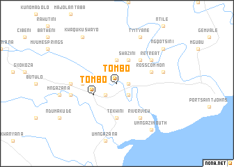
Tombo (South Africa)Tombo is a town in South Africa. An overview map of the region around Tombo is displayed below.
regional and 3d topo map of Tombo, South Africa ::
Tombo airports ::
The nearest airport is UTT - Umtata Mthatha, located 69.1 km west of Tombo.
Other airports nearby include MGH - Margate (121.9 km north east), ELS - East London (217.5 km south west), DUR - Durban Intl (233.8 km north east), PZB - Pietermaritzburg (236.5 km north east), Nearby towns ::
Ngqwangu (1.6km east) //
KwaRela (2.4km south west) //
Big Umngazi (2.4km south east) //
Bizana (3.7km north) //
Kohlogolo (3.7km north) //
Tombo (3.7km south west) //
Swazini (4.0km north east) //
Fort Harrison (4.9km north east) //
Lugaqweni (4.9km north east) //
Tekwini (5.6km south) //
Mzilanga (4.7km west) //
Ross Common (5.1km east) //
River View (6.4km south east) //
Retreat (6.0km north east) //
Ntsimbini (6.3km west) //
Glengazi (6.6km west) //
Isinuka (6.6km east) //
Tyityane (8.1km north east) //
Umngazi Mouth (8.8km south east) //
KwaQukuswayo (8.8km north west) //
Ngqotsini (8.4km north east) //
[all distances 'as the bird flies' and approximate]  Places with similar names to Tombo, South Africa ::
Disclaimer :: Information on this page comes without warranty of any kind |
||
|
Where is Tombo? Elevation and coordinates ::
Latitude (lat): 31°36'0"S Longitude (lon): 29°24'0"E
Elevation (approx.): 45m (map arrows pan, magnifying glasses zoom) |
||
|
Visiting Tombo? Hotel/Accommodation ::
Book a hotel in Tombo Travel Guide ::
rental cars ::
car rental offers GPS waypoint ::
download a GPX waypoint (PoI) of Tombo for your GPS receiver
|
||