|
search place name
|
||
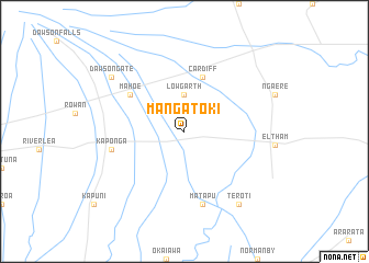
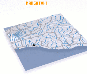
Mangatoki (Akaroa, New Zealand)Mangatoki is a town in the Akaroa region of New Zealand. An overview map of the region around Mangatoki is displayed below.
regional and 3d topo map of Mangatoki, New Zealand ::
Mangatoki airports ::
The nearest airport is NPL - New Plymouth, located 45.4 km north of Mangatoki.
Other airports nearby include WAG - Wanganui (92.1 km south east), PMR - Palmerston North (156.3 km south east), PPQ - Paraparaumu (177.9 km south), TUO - Taupo (178.2 km north east), Nearby towns ::
 Places with similar names to Mangatoki, New Zealand ::
// Mān Katkau (MM)
// Maungto Auk (MM)
// Manokotak (US)
// Menikhtaíika (GR)
// Mangatoka (MG)
// Mangatoka (MG)
// Mangoudougou (BF)
// Mingteke (KG)
// Manak Deki (PK)
// Manga Doga (PK)
Disclaimer :: Information on this page comes without warranty of any kind |
||
|
Where is Mangatoki? Elevation and coordinates ::
Latitude (lat): 39°25'0"S Longitude (lon): 174°13'0"E
Elevation (approx.): 274m (map arrows pan, magnifying glasses zoom) |
||
|
Visiting Mangatoki? Hotel/Accommodation ::
Book a hotel in Mangatoki Travel Guide ::
Buy a travel guide for New Zealand rental cars ::
car rental offers GPS waypoint ::
download a GPX waypoint (PoI) of Mangatoki for your GPS receiver
|
||