|
search place name
|
||
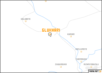
Glukhari (Amurskaya Oblast', Russia)Glukhari is a town in the Amurskaya Oblast' region of Russia. An overview map of the region around Glukhari is displayed below.
regional and 3d topo map of Glukhari, Russia ::
Glukhari airports ::
The nearest airport is BQS - Blagoveschensk Ignatyevo, located 152.6 km south of Glukhari.
Nearby towns ::
Kurgan (4.6km east) //
[all distances 'as the bird flies' and approximate]  Places with similar names to Glukhari, Russia ::
// Kālākhor (IN)
// Kālukheri (IN)
// Kaula Kheri (IN)
// Koil Khera (IN)
// Kolūkheri (IN)
// Guilikhar (SN)
// Galeh Khar (IR)
// Galleh Khar (IR)
// Gol Ākher (IR)
// Gol-e Khār (IR)
Disclaimer :: Information on this page comes without warranty of any kind |
||
|
Where is Glukhari? Elevation and coordinates ::
Latitude (lat): 51°44'0"N Longitude (lon): 128°4'0"E
Elevation (approx.): 250m (map arrows pan, magnifying glasses zoom) |
||
|
Visiting Glukhari? Hotel/Accommodation ::
Book a hotel in Glukhari Travel Guide ::
Buy a travel guide for Russia rental cars ::
car rental offers GPS waypoint ::
download a GPX waypoint (PoI) of Glukhari for your GPS receiver
|
||