|
search place name
|
||
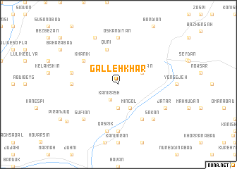
Galleh Khar (Ostān-e Āz̄arbāyjān-e Gharbī, Iran)Galleh Khar is a town in the Ostān-e Āz̄arbāyjān-e Gharbī region of Iran. An overview map of the region around Galleh Khar is displayed below.
regional and 3d topo map of Galleh Khar, Iran ::
Galleh Khar airports ::
The nearest airport is VAN - Van, located 134.2 km north west of Galleh Khar.
Other airports nearby include TBZ - Tabriz Intl (134.8 km east), Nearby towns ::
Kānī Rash (2.6km south west) //
Şūrmānābād (3.7km south) //
Mīngol (4.0km south) //
Mastakān (3.5km north east) //
Qūnī (5.7km north) //
Khānīk (5.7km north west) //
Bachehjīk (6.3km south east) //
Oskandīyān (7.4km north) //
Qūrmīk (5.8km west) //
Kānī Shamdīn (7.4km south) //
Ghāzān (6.1km west) //
Qaşrīk (7.6km south) //
Şūfīān (7.1km south west) //
Mīrābād (7.1km south east) //
Sākān (7.1km south east) //
Jatar (6.9km south east) //
Bastakābād (8.0km north) //
Kharah Gūsh (8.7km south west) //
[all distances 'as the bird flies' and approximate]  Places with similar names to Galleh Khar, Iran ::
// Glukhari (RU)
// Kālākhor (IN)
// Kālukheri (IN)
// Kaula Kheri (IN)
// Koil Khera (IN)
// Kolūkheri (IN)
// Guilikhar (SN)
// Galeh Khar (IR)
// Gol Ākher (IR)
// Gol-e Khār (IR)
Disclaimer :: Information on this page comes without warranty of any kind |
||
|
Where is Galleh Khar? Elevation and coordinates ::
Latitude (lat): 37°57'0"N Longitude (lon): 44°43'0"E
Elevation (approx.): 1922m (map arrows pan, magnifying glasses zoom) |
||
|
Visiting Galleh Khar? Hotel/Accommodation ::
Book a hotel in Galleh Khar Travel Guide ::
Buy a travel guide for Iran rental cars ::
car rental offers GPS waypoint ::
download a GPX waypoint (PoI) of Galleh Khar for your GPS receiver
|
||