|
search place name
|
||
Khatusha (Kurskaya Oblast', Russia)Khatusha is a town in the Kurskaya Oblast' region of Russia. An overview map of the region around Khatusha is displayed below.
regional and 3d topo map of Khatusha, Russia ::

Khatusha airports ::
The nearest airport is BZK - Bryansk, located 139.9 km north of Khatusha.
Nearby towns ::
Starsheye (3.5km north) //
Mel'nichishche (3.5km north) //
Yudovka (4.2km south) //
Klintsy (4.8km north) //
Aleksina (5.1km north) //
Yudina (5.5km south) //
Dubovitsa (3.9km south west) //
Starshenskiy (4.1km east) //
Khomutovka (6.7km south) //
Romanovo (5.9km south east) //
Starshinskiy (5.2km north east) //
Shagarovo (5.1km west) //
Novyy Svet (6.9km south east) //
Pogreby (8.7km north) //
Podlesnaya Polyana (5.7km east) //
Samofalovka (8.8km north east) //
Smorodino (9.9km south east) //
Kul'tprosvet (9.8km south west) //
[all distances 'as the bird flies' and approximate] 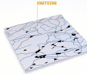 Places with similar names to Khatusha, Russia ::
// Kahatchee (US)
// Khatusha (RU)
// Khotoch (RU)
// Khotusha (RU)
// Khātāsia (BD)
// Cahuatache (MX)
// Khatcha (UZ)
// Khatcha (UZ)
// Khatcha (UZ)
// Kheydehchī (IR)
Disclaimer :: Information on this page comes without warranty of any kind |
||
|
Where is Khatusha? Elevation and coordinates ::
Latitude (lat): 51°58'52"N Longitude (lon): 34°34'55"E
Elevation (approx.): 180m (map arrows pan, magnifying glasses zoom) |
||
|
Visiting Khatusha? Hotel/Accommodation ::
Book a hotel in Khatusha Travel Guide ::
Buy a travel guide for Russia rental cars ::
car rental offers GPS waypoint ::
download a GPX waypoint (PoI) of Khatusha for your GPS receiver
|
||