|
search place name
|
||
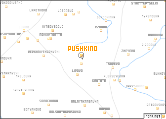
Pushkino (Tul'skaya Oblast', Russia)Pushkino is a town in the Tul'skaya Oblast' region of Russia. An overview map of the region around Pushkino is displayed below.
regional and 3d topo map of Pushkino, Russia ::
Pushkino airports ::
The nearest airport is VKO - Moscow Vnukovo, located 204.7 km north of Pushkino.
Other airports nearby include VOZ - Voronezh Chertovitskoye (245.2 km south east), Nearby towns ::
Chermoshnya (1.0km south) //
L'vovo (2.4km north) //
Lipovo (3.5km south) //
Krutoye (6.1km south) //
Tsarëvo (4.5km south east) //
Rzhavo (6.9km north) //
Alekseyevka (6.3km south east) //
Rovki Vtoryye (6.4km north west) //
Verkhniye Marmyzhi (5.3km west) //
Rovki (6.5km north west) //
Rovki Pervyye (6.5km north west) //
Myasoyedovo (7.6km north west) //
Katrevo (6.9km south east) //
Sorochinka (9.2km north) //
[all distances 'as the bird flies' and approximate] 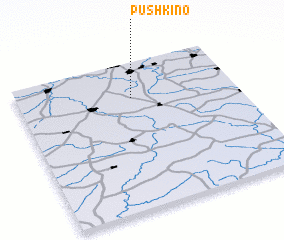 Places with similar names to Pushkino, Russia ::
Disclaimer :: Information on this page comes without warranty of any kind |
||
|
Where is Pushkino? Elevation and coordinates ::
Latitude (lat): 53°45'31"N Longitude (lon): 37°31'10"E
Elevation (approx.): 229m (map arrows pan, magnifying glasses zoom) |
||
|
Visiting Pushkino? Hotel/Accommodation ::
Book a hotel in Pushkino Travel Guide ::
Buy a travel guide for Russia rental cars ::
car rental offers GPS waypoint ::
download a GPX waypoint (PoI) of Pushkino for your GPS receiver
|
||