|
search place name
|
||
Sandilovo (Tverskaya Oblast', Russia)Sandilovo is a town in the Tverskaya Oblast' region of Russia. An overview map of the region around Sandilovo is displayed below.
regional and 3d topo map of Sandilovo, Russia ::

Sandilovo airports ::
The nearest airport is KLD - Tver Migalovo, located 100.7 km south east of Sandilovo.
Nearby towns ::
Lyapunikha (2.2km south east) //
Lipunikha (2.7km south east) //
Ozarennyy (4.5km south) //
Ososovo (3.0km east) //
Trudovoy (6.0km south) //
Bol'shaya Varezha (6.7km north) //
Fedovo (5.9km north) //
Osechenka (5.3km south west) //
Tsna (7.5km south) //
Malaya Varizha (7.5km north) //
Bor (5.4km north east) //
Yelizavetino (6.3km south west) //
Granitsa (6.6km north east) //
Myakishevo (7.7km north) //
[all distances 'as the bird flies' and approximate] 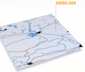 Places with similar names to Sandilovo, Russia ::
// Saint Olaf (US)
// Santa Oliva (ES)
// San Adolfo (CO)
// Santa Elva (PE)
// Saint-Éliph (FR)
// Sainte-Olive (FR)
// Saint-Oulph (FR)
// SantʼAlfio (IT)
// SantʼOliva (IT)
// Sandalovo (RU)
Disclaimer :: Information on this page comes without warranty of any kind |
||
|
Where is Sandilovo? Elevation and coordinates ::
Latitude (lat): 57°35'0"N Longitude (lon): 34°51'0"E
Elevation (approx.): 159m (map arrows pan, magnifying glasses zoom) |
||
|
Visiting Sandilovo? Hotel/Accommodation ::
Book a hotel in Sandilovo Travel Guide ::
Buy a travel guide for Russia rental cars ::
car rental offers GPS waypoint ::
download a GPX waypoint (PoI) of Sandilovo for your GPS receiver
|
||