|
search place name
|
||
Staroye Yansitovo (Chuvashiya, Russia)Staroye Yansitovo is a town in the Chuvashiya region of Russia. An overview map of the region around Staroye Yansitovo is displayed below.
regional and 3d topo map of Staroye Yansitovo, Russia ::

Staroye Yansitovo airports ::
The nearest airport is KZN - Kazan, located 88.0 km east of Staroye Yansitovo.
Nearby towns ::
Sine-Kinchery (1.5km east) //
Voznesenskoye (2.5km south west) //
Yantikovo (3.4km north) //
Chegeduyevo (4.4km south) //
Kul'geshi (4.3km south east) //
Sitmishi (6.0km south) //
Baygulovo (5.6km north east) //
Olmaluy (5.1km north west) //
(( Maldy-Kasy )) (5.5km south west) //
Shimalakhovo (4.2km west) //
Ablyazovo (6.0km north west) //
Kugeyevo (7.5km north) //
Shikhabylovo (5.7km south west) //
Verkhneye Baygulovo (7.0km north) //
Chuvashskoye Isenevo (5.0km north west) //
Anatkasy (7.8km south) //
Kalugino (6.2km north west) //
(( Syundyukovo )) (8.6km north) //
Tansarino (5.8km south east) //
Yambay (8.9km south) //
Staroye Sheptakhovo (8.8km south west) //
Chinery (8.5km north west) //
[all distances 'as the bird flies' and approximate] 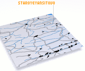 Places with similar names to Staroye Yansitovo, Russia :: Disclaimer :: Information on this page comes without warranty of any kind |
||
|
Where is Staroye Yansitovo? Elevation and coordinates ::
Latitude (lat): 55°47'24"N Longitude (lon): 47°55'3"E
Elevation (approx.): 90m (map arrows pan, magnifying glasses zoom) |
||
|
Visiting Staroye Yansitovo? Hotel/Accommodation ::
Book a hotel in Staroye Yansitovo Travel Guide ::
Buy a travel guide for Russia rental cars ::
car rental offers GPS waypoint ::
download a GPX waypoint (PoI) of Staroye Yansitovo for your GPS receiver
|
||