|
search place name
|
||
Vurmankasy (Chuvashiya, Russia)Vurmankasy is a town in the Chuvashiya region of Russia. An overview map of the region around Vurmankasy is displayed below.
regional and 3d topo map of Vurmankasy, Russia ::

Vurmankasy airports ::
The nearest airport is KZN - Kazan, located 100.0 km south east of Vurmankasy.
Nearby towns ::
Il'men'kasy (2.8km south) //
Togayevo (1.8km east) //
Devletgil'dino (2.9km south east) //
El'barusovo (2.1km west) //
Peredniye Bokashi (4.6km south) //
(( Bol'shiye Timerchi )) (4.5km south east) //
Isterekkasy (4.7km south east) //
Akshiki (5.8km south) //
Bol'shoye Yanduganovo (4.5km north west) //
Sredniye Bokashi (5.0km south west) //
Khorn'yaly (5.8km south west) //
Vurman-Pilemchi (4.0km east) //
Oktyabr'skoye (7.5km south) //
Uskasy (4.9km south west) //
Sotnikovo (6.6km north west) //
(( Kuznetsovo )) (6.6km south east) //
(( Maloye Akkozino )) (7.8km south) //
Astakasy (8.1km north) //
Bol'shoye Akkozino (8.2km south) //
(( Verkhniye Karabashi )) (4.9km east) //
Ityakovo (9.4km south) //
Kuzhmary (9.9km south east) //
[all distances 'as the bird flies' and approximate] 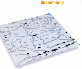 Places with similar names to Vurmankasy, Russia ::
// Vurmankasy (RU)
// Vurmankasy (RU)
// Vurmankasy (RU)
// Vurmankasy (RU)
// Vurmankasy (RU)
// Vurmankasy (RU)
// Vurmankasy (RU)
// Vurmankasy (RU)
// Vurmankasy (RU)
// Vurmankasy (RU)
Disclaimer :: Information on this page comes without warranty of any kind |
||
|
Where is Vurmankasy? Elevation and coordinates ::
Latitude (lat): 55°58'13"N Longitude (lon): 47°49'19"E
Elevation (approx.): 158m (map arrows pan, magnifying glasses zoom) |
||
|
Visiting Vurmankasy? Hotel/Accommodation ::
Book a hotel in Vurmankasy Travel Guide ::
Buy a travel guide for Russia rental cars ::
car rental offers GPS waypoint ::
download a GPX waypoint (PoI) of Vurmankasy for your GPS receiver
|
||