|
search place name
|
||
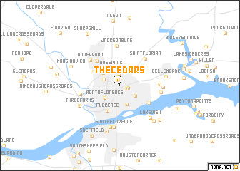
The Cedars (Alabama, United States - USA)The Cedars is a town in the Alabama region of United States - USA. An overview map of the region around The Cedars is displayed below.
regional and 3d topo map of The Cedars, United States - USA ::
The Cedars airports ::
The nearest airport is HUA - Redstone Aaf, located 90.9 km east of The Cedars.
Other airports nearby include MKL - Jackson Mc Kellar Sipes Rgnl (142.4 km north west), CBM - Colombus Columbus Afb (150.7 km south west), BHM - Birmingham Intl (164.0 km south east), BNA - Nashville Intl (168.5 km north east), Nearby towns ::
Hickory Hills (1.0km south east) //
Greenbrier (1.1km east) //
Mars Hill (1.8km north) //
Sherwood Forest (2.2km north west) //
Weeden Heights (2.5km south east) //
North Florence (2.7km south west) //
Rose Park (3.0km north west) //
East Florence (3.0km south) //
Forest Hills (2.9km north west) //
Petersville (3.7km north west) //
Florence (4.3km south) //
Northwood Hills (4.0km north west) //
Cloverdale Heights (4.8km north west) //
Lakeside Highlands (4.6km south east) //
Saint Florian (5.3km north east) //
Underwood (5.5km north west) //
Jacksonburg (6.2km north) //
Woodlawn (5.1km east) //
Cypress Heights (5.3km west) //
Indian Springs (5.4km east) //
South Florence (6.6km south) //
Cliff Haven (6.6km south) //
Rivermont (5.6km east) //
Lakeview (6.4km south east) //
Three Forks (6.1km south west) //
Bellemeade (6.0km east) //
East Sheffield (7.4km south) //
Steenson Hollow (7.1km south east) //
Lakeview Highlands (7.4km south east) //
[all distances 'as the bird flies' and approximate]  Places with similar names to The Cedars, United States - USA ::
// The Cedars (US)
// The Cedars (US)
// The Cedars (US)
// The Cedars (US)
// The Cedars (ZA)
// The Cedars (US)
// The Cedars (IE)
Disclaimer :: Information on this page comes without warranty of any kind |
||
|
Where is The Cedars? Elevation and coordinates ::
Latitude (lat): 34°50'8"N Longitude (lon): 87°39'34"W
Elevation (approx.): 186m (map arrows pan, magnifying glasses zoom) |
||
|
Visiting The Cedars? Hotel/Accommodation ::
Book a hotel in The Cedars Travel Guide ::
rental cars ::
car rental offers GPS waypoint ::
download a GPX waypoint (PoI) of The Cedars for your GPS receiver
|
||