|
search place name
|
||
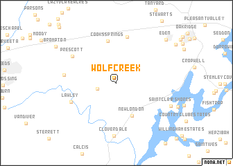
Wolf Creek (Alabama, United States - USA)Wolf Creek is a town in the Alabama region of United States - USA. An overview map of the region around Wolf Creek is displayed below.
regional and 3d topo map of Wolf Creek, United States - USA ::
Wolf Creek airports ::
The nearest airport is BHM - Birmingham Intl, located 34.7 km west of Wolf Creek.
Other airports nearby include ANB - Anniston Metro (49.1 km east), MXF - Montgomery Maxwell Afb (127.1 km south), HUA - Redstone Aaf (130.5 km north), MGE - Marietta Dobbins Arb (Atlanta Nas) (178.1 km east), Nearby towns ::
Pleasant Grove (2.7km west) //
New London (5.7km south) //
Cooks Springs (6.9km north) //
Chulavista (7.5km north) //
Lawley (6.8km south west) //
Prescott (7.3km north west) //
Stewarts Crossroads (7.1km west) //
Cloverdale (8.5km south) //
Saint Clair Shores (8.2km south east) //
Eden (9.6km north east) //
[all distances 'as the bird flies' and approximate] 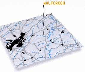 Places with similar names to Wolf Creek, United States - USA ::
// Wolf Creek (US)
// Wolf Creek (US)
// Wolf Creek (US)
// Wolf Creek (US)
// Wolf Creek (US)
// Wolf Creek (US)
// Wolf Creek (US)
// Wolf Creek (US)
// Wolf Creek (US)
// Wolf Creek (US)
Disclaimer :: Information on this page comes without warranty of any kind |
||
|
Where is Wolf Creek? Elevation and coordinates ::
Latitude (lat): 33°31'45"N Longitude (lon): 86°22'55"W
Elevation (approx.): 150m (map arrows pan, magnifying glasses zoom) |
||
|
Visiting Wolf Creek? Hotel/Accommodation ::
Book a hotel in Wolf Creek Travel Guide ::
rental cars ::
car rental offers GPS waypoint ::
download a GPX waypoint (PoI) of Wolf Creek for your GPS receiver
|
||