|
search place name
|
||
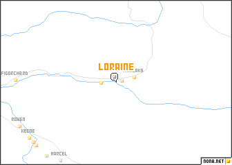
Loraine (California, United States - USA)Loraine is a town in the California region of United States - USA. An overview map of the region around Loraine is displayed below.
regional and 3d topo map of Loraine, United States - USA ::
Loraine airports ::
The nearest airport is BFL - Bakersfield Meadows Fld, located 58.2 km west of Loraine.
Other airports nearby include EDW - Edwards Afb (67.1 km south east), PMD - Palmdale Rgnl Usaf Plt 42 (81.5 km south east), BUR - Burbank Bob Hope (122.7 km south), NTD - Point Mugu Nas (145.6 km south west), Nearby towns ::
Sand Canyon (0.8km north east) //
Millersville (1.9km west) //
Twin Oaks (2.6km east) //
[all distances 'as the bird flies' and approximate] 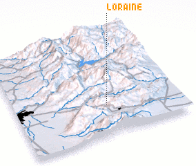 Places with similar names to Loraine, United States - USA ::
Disclaimer :: Information on this page comes without warranty of any kind |
||
|
Where is Loraine? Elevation and coordinates ::
Latitude (lat): 35°18'17"N Longitude (lon): 118°26'9"W
Elevation (approx.): 825m (map arrows pan, magnifying glasses zoom) |
||
|
Visiting Loraine? Hotel/Accommodation ::
Book a hotel in Loraine Travel Guide ::
rental cars ::
car rental offers GPS waypoint ::
download a GPX waypoint (PoI) of Loraine for your GPS receiver
|
||