|
search place name
|
||
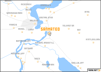
San Mateo (Florida, United States - USA)San Mateo is a town in the Florida region of United States - USA. An overview map of the region around San Mateo is displayed below.
regional and 3d topo map of San Mateo, United States - USA ::
San Mateo airports ::
The nearest airport is GNV - Gainesville Rgnl, located 67.2 km west of San Mateo.
Other airports nearby include NIP - Jacksonville Nas (70.4 km north), JAX - Jacksonville Intl (98.9 km north), MCO - Orlando Intl (133.2 km south), COF - Coco Beach Patrick Afb (179.3 km south east), Nearby towns ::
Sutherlands Still (4.1km south west) //
East Palatka (5.9km north) //
Lundy (6.2km west) //
Yelvington (6.5km north east) //
Palatka (6.9km north west) //
Orange Mills (8.8km north) //
Satsuma (9.0km south west) //
Pecan (11.0km north west) //
[all distances 'as the bird flies' and approximate] 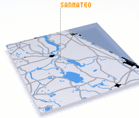 Places with similar names to San Mateo, United States - USA ::
// San Emidio (US)
// San Mateo (US)
// Sunnymead (US)
// San Mateo (US)
// Sunnymeadow (US)
// Sunnymede (US)
// San Mateo (PA)
// San Mateo (CU)
// San Mateo (CU)
// Sinoahmet (TR)
Disclaimer :: Information on this page comes without warranty of any kind |
||
|
Where is San Mateo? Elevation and coordinates ::
Latitude (lat): 29°36'23"N Longitude (lon): 81°35'5"W
Elevation (approx.): 33m (map arrows pan, magnifying glasses zoom) |
||
|
Visiting San Mateo? Hotel/Accommodation ::
Book a hotel in San Mateo Travel Guide ::
rental cars ::
car rental offers GPS waypoint ::
download a GPX waypoint (PoI) of San Mateo for your GPS receiver
|
||