|
search place name
|
||
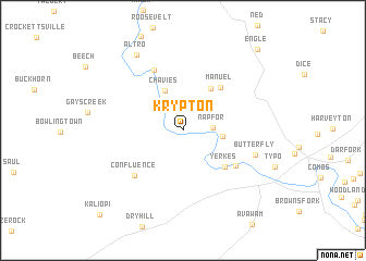
Krypton (Kentucky, United States - USA)Krypton is a town in the Kentucky region of United States - USA. An overview map of the region around Krypton is displayed below.
regional and 3d topo map of Krypton, United States - USA ::
Krypton airports ::
The nearest airport is TYS - Knoxville Mc Ghee Tyson, located 176.5 km south of Krypton.
Other airports nearby include LUK - Cincinnati Muni Lunken Fld (220.2 km north west), CVG - Cincinnati Northern Kentucky Intl (225.3 km north west), HKY - Hickory Rgnl (246.7 km south east), Nearby towns ::
Napfor (2.4km east) //
Dunraven (3.3km east) //
Chavies (4.3km north) //
Lamont (4.9km north east) //
Yerkes (5.1km south east) //
Manuel (5.4km north east) //
Busy (5.7km south east) //
Confluence (6.1km south west) //
Barwick (6.6km north) //
Butterfly (6.4km south east) //
Altro (8.6km north west) //
Engle (10.3km north east) //
Kaliopi (11.0km south west) //
[all distances 'as the bird flies' and approximate]  Places with similar names to Krypton, United States - USA ::
// Gura Padinii (RO)
// Gura Putnei (RO)
// Kuropatin (RU)
// Kuropatino (RU)
// Grapetown (US)
// Gurapatan (IN)
// Kārpedīn (IR)
// Creptaine (HT)
// Garpu Town (LR)
// Cropton (GB)
Disclaimer :: Information on this page comes without warranty of any kind |
||
|
Where is Krypton? Elevation and coordinates ::
Latitude (lat): 37°18'40"N Longitude (lon): 83°20'22"W
Elevation (approx.): 244m (map arrows pan, magnifying glasses zoom) |
||
|
Visiting Krypton? Hotel/Accommodation ::
Book a hotel in Krypton Travel Guide ::
rental cars ::
car rental offers GPS waypoint ::
download a GPX waypoint (PoI) of Krypton for your GPS receiver
|
||