|
search place name
|
||
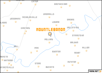
Mount Lebanon (Kentucky, United States - USA)Mount Lebanon is a town in the Kentucky region of United States - USA. An overview map of the region around Mount Lebanon is displayed below.
regional and 3d topo map of Mount Lebanon, United States - USA ::
Mount Lebanon airports ::
The nearest airport is LOU - Louisville Bowman Fld, located 111.1 km north west of Mount Lebanon.
Other airports nearby include FTK - Fort Knox Godman Aaf (129.4 km west), CVG - Cincinnati Northern Kentucky Intl (136.4 km north), LUK - Cincinnati Muni Lunken Fld (141.9 km north), FFO - Dayton Wright Patterson Afb (225.5 km north), Nearby towns ::
Pollard (2.3km south) //
Logana (4.5km north) //
Cuzick (4.5km east) //
Edenton (6.9km south) //
Union Mills (7.1km north) //
Pink (6.7km south west) //
Valley View (6.8km east) //
Spears (7.8km north east) //
Little Hickman (8.3km south west) //
Baldwin (7.7km south east) //
Nicholasville (8.5km north west) //
[all distances 'as the bird flies' and approximate] 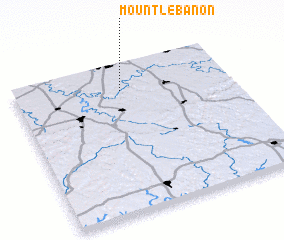 Places with similar names to Mount Lebanon, United States - USA ::
// Mount Lebanon (US)
// Mount Lebanon (US)
// Mount Lebanon (US)
// Mount Lebanon (US)
// Mount Lebanon (US)
// Mount Lebanon (US)
// Mount Lebanon (US)
// Mount Lebanon (US)
// Mount Lebanon (US)
Disclaimer :: Information on this page comes without warranty of any kind |
||
|
Where is Mount Lebanon? Elevation and coordinates ::
Latitude (lat): 37°49'36"N Longitude (lon): 84°30'16"W
Elevation (approx.): 289m (map arrows pan, magnifying glasses zoom) |
||
|
Visiting Mount Lebanon? Hotel/Accommodation ::
Book a hotel in Mount Lebanon Travel Guide ::
rental cars ::
car rental offers GPS waypoint ::
download a GPX waypoint (PoI) of Mount Lebanon for your GPS receiver
|
||