|
search place name
|
||
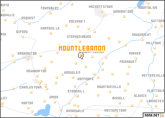
Mount Lebanon (New Jersey, United States - USA)Mount Lebanon is a town in the New Jersey region of United States - USA. An overview map of the region around Mount Lebanon is displayed below.
regional and 3d topo map of Mount Lebanon, United States - USA ::
Mount Lebanon airports ::
The nearest airport is TTN - Trenton Mercer, located 53.5 km south of Mount Lebanon.
Other airports nearby include EWR - Newark Liberty Intl (59.5 km east), NXX - Willow Grove Nas Jrb (66.3 km south), TEB - Teterboro (68.9 km east), LGA - New York La Guardia (84.1 km east), Nearby towns ::
Anthony (1.5km south west) //
Little Brook (1.8km south) //
Scrappy Corner (1.7km east) //
Pleasant Grove (2.9km north east) //
Stephensburg (4.0km north) //
Lower Valley (3.9km south east) //
Penwell (3.8km north west) //
Crestmoore (3.6km east) //
Woodglen (4.5km south) //
Vernoy (4.2km south east) //
Middle Valley (4.0km east) //
Califon (5.0km south east) //
Hoffmans (5.7km south) //
Newport (5.0km south west) //
Anderson (4.6km west) //
Port Murray (5.2km north west) //
Bunnvale (6.3km south) //
Beattystown (6.6km north) //
Beattyestown (7.0km north) //
Butler Park (5.4km west) //
Red Mill (6.1km south west) //
Rockport (7.5km north) //
Farmersville (6.2km south east) //
Schooleys Mountain (6.5km north east) //
Spruce Run (7.1km south west) //
Readingsburg (8.4km south) //
Stone Mill (8.5km south) //
Mount Bethel (8.2km north) //
Changewater (6.8km west) //
[all distances 'as the bird flies' and approximate] 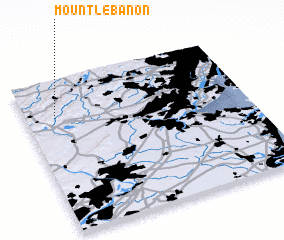 Places with similar names to Mount Lebanon, United States - USA ::
// Mount Lebanon (US)
// Mount Lebanon (US)
// Mount Lebanon (US)
// Mount Lebanon (US)
// Mount Lebanon (US)
// Mount Lebanon (US)
// Mount Lebanon (US)
// Mount Lebanon (US)
// Mount Lebanon (US)
Disclaimer :: Information on this page comes without warranty of any kind |
||
|
Where is Mount Lebanon? Elevation and coordinates ::
Latitude (lat): 40°45'25"N Longitude (lon): 74°52'5"W
Elevation (approx.): 290m (map arrows pan, magnifying glasses zoom) |
||
|
Visiting Mount Lebanon? Hotel/Accommodation ::
Book a hotel in Mount Lebanon Travel Guide ::
rental cars ::
car rental offers GPS waypoint ::
download a GPX waypoint (PoI) of Mount Lebanon for your GPS receiver
|
||