|
search place name
|
||
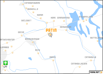
Patin (Louisiana, United States - USA)Patin is a town in the Louisiana region of United States - USA. An overview map of the region around Patin is displayed below.
regional and 3d topo map of Patin, United States - USA ::
Patin airports ::
The nearest airport is LFT - Lafayette Rgnl, located 17.2 km south west of Patin.
Other airports nearby include BTR - Baton Rouge Metro Ryan Fld (71.4 km east), ESF - Alexandria Esler Rgnl (130.1 km north), AEX - Alexandria Intl (133.7 km north west), LCH - Lake Charles Rgnl (134.7 km west), Nearby towns ::
Nina Station (1.7km north) //
Champagne (1.7km north west) //
Cecilia (5.4km north) //
Henderson (5.2km north east) //
Hope (5.9km north) //
Breaux Bridge (6.2km west) //
Grand Annse (7.0km north east) //
Ruth (7.2km south west) //
Huron (7.7km north west) //
Parks (8.5km south) //
[all distances 'as the bird flies' and approximate] 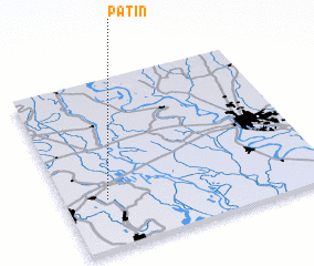 Places with similar names to Patin, United States - USA ::
Disclaimer :: Information on this page comes without warranty of any kind |
||
|
Where is Patin? Elevation and coordinates ::
Latitude (lat): 30°17'25"N Longitude (lon): 91°50'15"W
Elevation (approx.): 8m (map arrows pan, magnifying glasses zoom) |
||
|
Visiting Patin? Hotel/Accommodation ::
Book a hotel in Patin Travel Guide ::
rental cars ::
car rental offers GPS waypoint ::
download a GPX waypoint (PoI) of Patin for your GPS receiver
|
||