|
search place name
|
||
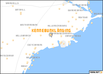
Kennebunk Landing (Maine, United States - USA)Kennebunk Landing is a town in the Maine region of United States - USA. An overview map of the region around Kennebunk Landing is displayed below.
regional and 3d topo map of Kennebunk Landing, United States - USA ::
Kennebunk Landing airports ::
The nearest airport is PWM - Portland Intl Jetport, located 33.9 km north east of Kennebunk Landing.
Other airports nearby include BED - Bedford Laurence G Hanscom Fld (119.3 km south west), BOS - Boston General Edward Lawrence Logan Intl (119.7 km south), PVD - Providence Theodore Francis Green State (197.5 km south west), BGR - Bangor Intl (208.2 km north east), Nearby towns ::
Four Corners (2.6km south) //
Bartlett Mills (2.9km north west) //
Arundel (2.5km east) //
Town House Corners (2.6km east) //
Coopers Corner (3.0km south east) //
Kennebunk Beach (3.7km south) //
Millers Crossing (3.5km north east) //
Lower Village (3.2km south east) //
Kennebunkport (3.1km south east) //
Kennebunk (3.0km west) //
Wildes Corner (3.9km south east) //
Wildes District (4.8km east) //
Cozy Corners (5.7km south west) //
Turbats Creek (5.4km south east) //
Elms (6.0km south west) //
Drakes Island (6.8km south west) //
Cape Porpoise (5.7km east) //
Beacon Corner (7.2km north east) //
Upper Landing (7.1km south west) //
Adams Corner (6.7km north east) //
West Kennebunk (6.8km north west) //
Lower Landing (8.2km south west) //
Wells (8.5km south west) //
Tea Kettle Corner (9.1km north east) //
Wells Beach (9.6km south west) //
Oak Ridge (9.0km north east) //
Guinea Corner (10.8km north east) //
[all distances 'as the bird flies' and approximate]  Places with similar names to Kennebunk Landing, United States - USA :: Disclaimer :: Information on this page comes without warranty of any kind |
||
|
Where is Kennebunk Landing? Elevation and coordinates ::
Latitude (lat): 43°22'40"N Longitude (lon): 70°30'33"W
Elevation (approx.): 16m (map arrows pan, magnifying glasses zoom) |
||
|
Visiting Kennebunk Landing? Hotel/Accommodation ::
Book a hotel in Kennebunk Landing Travel Guide ::
rental cars ::
car rental offers GPS waypoint ::
download a GPX waypoint (PoI) of Kennebunk Landing for your GPS receiver
|
||