|
search place name
|
||
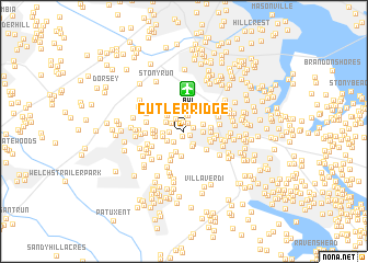
Cutler Ridge (Maryland, United States - USA)Cutler Ridge is a town in the Maryland region of United States - USA. An overview map of the region around Cutler Ridge is displayed below.
regional and 3d topo map of Cutler Ridge, United States - USA ::
Cutler Ridge airports ::
The nearest airport is BWI - Baltimore Washington Intl, located 4.3 km north of Cutler Ridge.
Other airports nearby include ADW - Camp Springs Andrews Afb (Washington Dc Naf) (39.9 km south west), DCA - Ronald Reagan Washington Natl (44.7 km south west), APG - Aberdeen Phillips Aaf (56.8 km north east), IAD - Washington Dulles Intl (71.1 km west), Nearby towns ::
Colonial Manor (0.6km south) //
Danza Village (0.6km south east) //
Northwood Estates (0.9km north) //
Elmhurst Estates (0.9km north) //
Elmhurst (0.8km north east) //
Delmont (1.4km south west) //
Crestwood Mobile Homes (1.3km north west) //
Stewart Corner (1.2km west) //
Washington Crest Heights (1.5km north west) //
Derby Farms (1.5km south east) //
Burleytown (1.7km north) //
Alberta Heights (1.7km north) //
Quarterfield Farms (1.6km south east) //
Severn Mobile Trailer Park (1.6km south west) //
Myers Estates (1.5km east) //
Elmhurst Ridge (1.6km north east) //
Munson Heights (1.7km north west) //
Andorick Acres (1.7km west) //
Wedgewood Forest (2.2km south) //
Severnsides (1.8km west) //
Merriweather (2.1km north west) //
Chesmar (2.6km south) //
Parke West (2.1km east) //
Woodside Square (2.1km east) //
Spaulding Knolls (2.2km south east) //
Ridgeway (2.6km south west) //
Stevenson Park (2.4km south east) //
Timber Ridge (2.6km north west) //
McPherson (2.9km north) //
[all distances 'as the bird flies' and approximate] 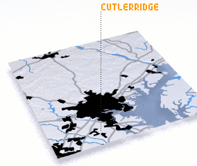 Places with similar names to Cutler Ridge, United States - USA ::
// Cutler Ridge (US)
// Cutler Ridge (US)
Disclaimer :: Information on this page comes without warranty of any kind |
||
|
Where is Cutler Ridge? Elevation and coordinates ::
Latitude (lat): 39°8'11"N Longitude (lon): 76°40'19"W
Elevation (approx.): 50m (map arrows pan, magnifying glasses zoom) |
||
|
Visiting Cutler Ridge? Hotel/Accommodation ::
Book a hotel in Cutler Ridge Travel Guide ::
rental cars ::
car rental offers GPS waypoint ::
download a GPX waypoint (PoI) of Cutler Ridge for your GPS receiver
|
||