|
search place name
|
||
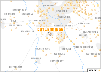
Cutler Ridge (South Carolina, United States - USA)Cutler Ridge is a town in the South Carolina region of United States - USA. An overview map of the region around Cutler Ridge is displayed below.
regional and 3d topo map of Cutler Ridge, United States - USA ::
Cutler Ridge airports ::
The nearest airport is AND - Andersen Anderson Rgnl, located 41.8 km south west of Cutler Ridge.
Other airports nearby include HKY - Hickory Rgnl (141.6 km north east), CLT - Charlotte Douglas Intl (142.8 km east), CAE - Colombia Columbia Metropolitan (151.8 km south east), AGS - Bush Field Augusta Rgnl At Bush Fld (162.3 km south), Nearby towns ::
West Gantt (0.5km east) //
Spring Brook Terrace (0.6km south east) //
Lakeside (1.3km south west) //
Rockvale (1.5km south) //
Gantt (1.9km north) //
Glendale (2.0km north east) //
Roseman Heights (2.1km east) //
Athelone Heights (2.1km east) //
Pine Hill Village (2.4km north east) //
The Highlands (2.3km east) //
Biltmore (2.8km north) //
Fairfield Acres (2.5km south east) //
Park Lane Terrace (2.7km south east) //
Pleasant Valley (2.8km north east) //
Belaire Estates (2.7km west) //
Elizabeth Heights (2.8km north west) //
Belle Meade (2.7km east) //
Staunton Heights (3.2km north west) //
Chestnut Hills (3.4km north) //
Supreme Forest (3.1km north west) //
Woodfields (3.0km east) //
Pecan Terrace (3.2km south east) //
South Forest Estates (3.1km east) //
Brookforest Estates (3.2km east) //
Oxford Acres (3.4km north west) //
Woodfield Heights (3.3km east) //
Holly Springs (3.6km south east) //
East Gantt (3.5km south east) //
Smith Heights (4.1km north) //
[all distances 'as the bird flies' and approximate] 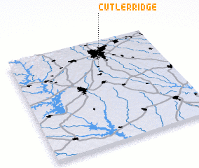 Places with similar names to Cutler Ridge, United States - USA ::
// Cutler Ridge (US)
// Cutler Ridge (US)
Disclaimer :: Information on this page comes without warranty of any kind |
||
|
Where is Cutler Ridge? Elevation and coordinates ::
Latitude (lat): 34°47'2"N Longitude (lon): 82°25'5"W
Elevation (approx.): 287m (map arrows pan, magnifying glasses zoom) |
||
|
Visiting Cutler Ridge? Hotel/Accommodation ::
Book a hotel in Cutler Ridge Travel Guide ::
rental cars ::
car rental offers GPS waypoint ::
download a GPX waypoint (PoI) of Cutler Ridge for your GPS receiver
|
||