|
search place name
|
||
Englandtowne (Maryland, United States - USA)Englandtowne is a town in the Maryland region of United States - USA. An overview map of the region around Englandtowne is displayed below.
regional and 3d topo map of Englandtowne, United States - USA ::

Englandtowne airports ::
The nearest airport is IAD - Washington Dulles Intl, located 47.2 km south of Englandtowne.
Other airports nearby include BWI - Baltimore Washington Intl (54.1 km east), DCA - Ronald Reagan Washington Natl (57.5 km south), ADW - Camp Springs Andrews Afb (Washington Dc Naf) (67.9 km south east), APG - Aberdeen Phillips Aaf (94.8 km east), Nearby towns ::
Tranquility (0.6km north west) //
Turners Chance (0.8km north east) //
Fountain Mills (0.9km west) //
New Market View (1.3km north) //
Friendship (1.4km south west) //
Highview (1.2km south west) //
Silver Maple Estates (1.3km south east) //
Sugarloaf Overlook (1.3km east) //
Chadwick (1.9km south) //
Fremont Hills (1.8km south west) //
Meadowbrook (2.0km south) //
Gently Savage (1.8km south west) //
Water View (2.2km north west) //
Watkins Wilderness (2.4km south) //
Ashley Acres (2.3km south east) //
Weller Estates (2.5km north) //
Farmfield Estates (2.0km east) //
Quail Run (2.5km south) //
Sunnybrook Farms (2.8km south) //
Smith (2.6km south west) //
Butterfield (2.7km north west) //
Fremont Acres (2.5km south east) //
Mid Country View (2.8km north) //
Wolf Den Spring (2.3km east) //
Tolley Terrace (2.8km north east) //
Hanford Estates (2.6km south east) //
Sweadner (2.8km south west) //
Stonelake (2.6km north east) //
Loch Haven (3.0km south west) //
[all distances 'as the bird flies' and approximate] 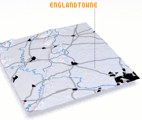 Places with similar names to Englandtowne, United States - USA :: Disclaimer :: Information on this page comes without warranty of any kind |
||
|
Where is Englandtowne? Elevation and coordinates ::
Latitude (lat): 39°20'27"N Longitude (lon): 77°15'28"W
Elevation (approx.): 188m (map arrows pan, magnifying glasses zoom) |
||
|
Visiting Englandtowne? Hotel/Accommodation ::
Book a hotel in Englandtowne Travel Guide ::
rental cars ::
car rental offers GPS waypoint ::
download a GPX waypoint (PoI) of Englandtowne for your GPS receiver
|
||