|
search place name
|
||
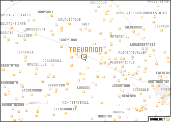
Trevanion (Maryland, United States - USA)Trevanion is a town in the Maryland region of United States - USA. An overview map of the region around Trevanion is displayed below.
regional and 3d topo map of Trevanion, United States - USA ::
Trevanion airports ::
The nearest airport is BWI - Baltimore Washington Intl, located 64.3 km south east of Trevanion.
Other airports nearby include MDT - Harrisburg Intl (70.9 km north east), IAD - Washington Dulles Intl (80.3 km south), APG - Aberdeen Phillips Aaf (85.3 km east), DCA - Ronald Reagan Washington Natl (86.2 km south), Nearby towns ::
Fairview Acres (1.5km south) //
Brown Heights (1.5km north west) //
Copperville (1.6km north west) //
Herring Estates (2.1km north west) //
Stumptown (2.8km north) //
Keyview (2.9km south) //
Tranquility Estates (2.9km north) //
Union Hills (2.9km south) //
Ottersdale (2.5km west) //
Otterdale Mill (2.5km west) //
Joseph Meadows (2.6km east) //
Mayberry Ridge (2.7km east) //
Mill Brothers Hills (3.1km south east) //
Liebno Estates (3.0km north east) //
Bear Run (2.9km east) //
Key Heights (3.9km south) //
Tyrone Acres (3.2km east) //
Wolfs Mill (4.0km north) //
Uniontown (4.0km south east) //
Bark Hill (4.3km south) //
Glenn Hill (4.6km south) //
Mayberry (3.9km north east) //
Clear Ridge (4.8km south) //
Tyrone (4.0km east) //
Larox Miracle Land (4.0km east) //
Runnymeade Summit (4.5km north east) //
The Meadows (4.7km south east) //
Taneytown (4.8km north west) //
Jessie Anne Estates (5.5km south) //
[all distances 'as the bird flies' and approximate] 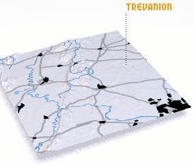 Places with similar names to Trevanion, United States - USA ::
// Travinino (RU)
// Trívounon (GR)
// Dirvonėnai (LT)
// Dirvonėnai (LT)
// Dervaniene (LV)
// Drovnino (RU)
// Drovnino (RU)
// Torghīnān (IR)
// Trevinano (IT)
// Tarvainen (FI)
Disclaimer :: Information on this page comes without warranty of any kind |
||
|
Where is Trevanion? Elevation and coordinates ::
Latitude (lat): 39°37'28"N Longitude (lon): 77°8'23"W
Elevation (approx.): 134m (map arrows pan, magnifying glasses zoom) |
||
|
Visiting Trevanion? Hotel/Accommodation ::
Book a hotel in Trevanion Travel Guide ::
rental cars ::
car rental offers GPS waypoint ::
download a GPX waypoint (PoI) of Trevanion for your GPS receiver
|
||