|
search place name
|
||
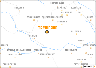
Trevinano (Italy)Trevinano is a town in Italy. An overview map of the region around Trevinano is displayed below.
regional and 3d topo map of Trevinano, Italy ::
Trevinano airports ::
The nearest airport is PEG - Perugia, located 61.2 km north east of Trevinano.
Other airports nearby include GRS - Grosseto (65.3 km west), SAY - Siena Ampugnano (69.8 km north west), FCO - Rome Fiumicino (116.8 km south), FLR - Firenze (122.7 km north west), Nearby towns ::
San Casciano dei Bagni (5.7km north) //
Centeno (4.5km south west) //
San Pietro (5.5km north east) //
Celle sul Rigo (6.9km north west) //
Proceno (7.9km south) //
Fighine (8.5km north east) //
Palazzone (9.2km north east) //
[all distances 'as the bird flies' and approximate]  Places with similar names to Trevinano, Italy ::
// Travinino (RU)
// Trívounon (GR)
// Dirvonėnai (LT)
// Dirvonėnai (LT)
// Dervaniene (LV)
// Drovnino (RU)
// Drovnino (RU)
// Trevanion (US)
// Torghīnān (IR)
// Tarvainen (FI)
Disclaimer :: Information on this page comes without warranty of any kind |
||
|
Where is Trevinano? Elevation and coordinates ::
Latitude (lat): 42°49'0"N Longitude (lon): 11°52'0"E
Elevation (approx.): 532m (map arrows pan, magnifying glasses zoom) |
||
|
Visiting Trevinano? Hotel/Accommodation ::
Book a hotel in Trevinano Travel Guide ::
Buy a travel guide for Italy rental cars ::
car rental offers GPS waypoint ::
download a GPX waypoint (PoI) of Trevinano for your GPS receiver
|
||