|
search place name
|
||
Winnecunnet (Massachusetts, United States - USA)Winnecunnet is a town in the Massachusetts region of United States - USA. An overview map of the region around Winnecunnet is displayed below.
regional and 3d topo map of Winnecunnet, United States - USA ::

Winnecunnet airports ::
The nearest airport is PVD - Providence Theodore Francis Green State, located 36.2 km south west of Winnecunnet.
Other airports nearby include BOS - Boston General Edward Lawrence Logan Intl (44.3 km north), BED - Bedford Laurence G Hanscom Fld (56.4 km north), CEF - Chicopee Falls Westover Arb Metropolitan (118.7 km west), ACK - Nantucket Mem (120.1 km south east), Nearby towns ::
Cranes Station (3.0km south west) //
East Norton (3.3km west) //
Easton (5.3km north) //
Five Corners (5.3km north) //
Ginty Corner (5.0km north west) //
Meadow Brook (5.3km south west) //
Pratts Corner (5.4km north east) //
Centre Mills (4.5km west) //
Copper Works (5.1km south west) //
Norton (4.8km west) //
Whittenton Junction (6.8km south) //
Prattville (5.9km south east) //
Britanniaville (6.7km south) //
Whittenton (6.4km south east) //
Raynham (5.6km south east) //
Oakland (7.3km south) //
East Mansfield (6.5km north west) //
Norton Grove (5.7km west) //
Easton Center (7.2km north east) //
Easton Station (7.5km north east) //
Algers Corner (6.5km north east) //
Morris Corner (7.8km north east) //
Barrowsville (7.0km south west) //
Gowards Corner (7.5km north east) //
Easton Green (8.4km north east) //
Whiteville (8.3km north west) //
Tracy Corner (7.6km south east) //
Eastondale (8.3km north east) //
South Easton (8.8km north east) //
[all distances 'as the bird flies' and approximate] 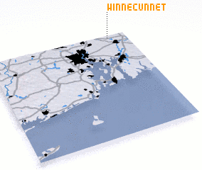 Places with similar names to Winnecunnet, United States - USA ::
// Wanakonde (NG)
// Wanikande (NG)
// Wanikanto (PG)
// Wān Kan Awt (MM)
// Wān Kè-inta (MM)
// Wan Konti (MM)
Disclaimer :: Information on this page comes without warranty of any kind |
||
|
Where is Winnecunnet? Elevation and coordinates ::
Latitude (lat): 41°58'35"N Longitude (lon): 71°7'50"W
Elevation (approx.): 23m (map arrows pan, magnifying glasses zoom) |
||
|
Visiting Winnecunnet? Hotel/Accommodation ::
Book a hotel in Winnecunnet Travel Guide ::
rental cars ::
car rental offers GPS waypoint ::
download a GPX waypoint (PoI) of Winnecunnet for your GPS receiver
|
||