|
search place name
|
||
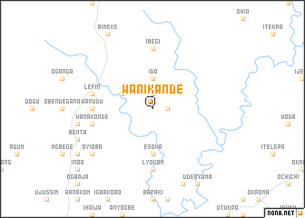
Wanikande (Gongola, Nigeria)Wanikande is a town in the Gongola region of Nigeria. An overview map of the region around Wanikande is displayed below.
regional and 3d topo map of Wanikande, Nigeria ::
Wanikande airports ::
The nearest airport is ENU - Enugu, located 108.5 km west of Wanikande.
Other airports nearby include MDI - Makurdi (111.5 km north), CBQ - Calabar (191.6 km south), BPC - Bamenda (192.1 km east), BFX - Bafoussam (240.7 km south east), Nearby towns ::
Ogangang (1.8km east) //
Wanishem (1.9km north) //
Ida (3.7km north) //
Elahen (4.1km north west) //
Esoka (5.6km south) //
Abeka (7.4km south) //
Ibegi (7.4km north) //
Lyokom (7.4km south) //
Wanudu (7.4km west) //
Wanakonde (7.6km west) //
Lefin (7.6km west) //
Oyioba (9.2km south west) //
[all distances 'as the bird flies' and approximate] 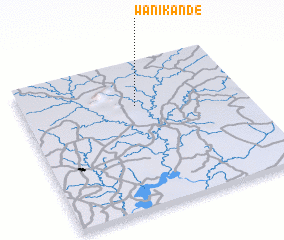 Places with similar names to Wanikande, Nigeria ::
// Winnecunnet (US)
// Wanakonde (NG)
// Wanikanto (PG)
// Wān Kan Awt (MM)
// Wān Kè-inta (MM)
// Wan Konti (MM)
Disclaimer :: Information on this page comes without warranty of any kind |
||
|
Where is Wanikande? Elevation and coordinates ::
Latitude (lat): 6°42'0"N Longitude (lon): 8°31'0"E
Elevation (approx.): 73m (map arrows pan, magnifying glasses zoom) |
||
|
Visiting Wanikande? Hotel/Accommodation ::
Book a hotel in Wanikande Travel Guide ::
Buy a travel guide for Nigeria rental cars ::
car rental offers GPS waypoint ::
download a GPX waypoint (PoI) of Wanikande for your GPS receiver
|
||