|
search place name
|
||
Lackey Hill (North Carolina, United States - USA)Lackey Hill is a town in the North Carolina region of United States - USA. An overview map of the region around Lackey Hill is displayed below.
regional and 3d topo map of Lackey Hill, United States - USA ::

Lackey Hill airports ::
The nearest airport is TYS - Knoxville Mc Ghee Tyson, located 65.2 km north west of Lackey Hill.
Other airports nearby include AND - Andersen Anderson Rgnl (124.0 km south east), CHA - Chattanooga Lovell Fld (166.7 km west), MGE - Marietta Dobbins Arb (Atlanta Nas) (195.6 km south west), ATL - Hartsfield Jackson Atlanta Intl (219.4 km south west), Nearby towns ::
Bryson City (1.1km south west) //
Franklin Grove (2.2km west) //
Ela (4.5km east) //
Jenkins Place (5.5km north) //
Jackson Line (5.4km south west) //
De Hart Mill (6.7km south west) //
Whittier (7.1km east) //
Solola Valley (8.7km north west) //
Lauada (9.3km south west) //
[all distances 'as the bird flies' and approximate] 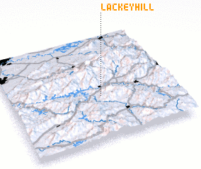 Places with similar names to Lackey Hill, United States - USA ::
// Lakehall (US)
// Laukhella (NO)
// Lake Hill (US)
// Luke Hill (BB)
// Lāukhola (BD)
// Lukhalo (ZM)
// Lakhāla (PK)
// Likhoele (LS)
// Lucky Hill (JM)
// Lake Hallie (US)
Disclaimer :: Information on this page comes without warranty of any kind |
||
|
Where is Lackey Hill? Elevation and coordinates ::
Latitude (lat): 35°26'13"N Longitude (lon): 83°26'19"W
Elevation (approx.): 545m (map arrows pan, magnifying glasses zoom) |
||
|
Visiting Lackey Hill? Hotel/Accommodation ::
Book a hotel in Lackey Hill Travel Guide ::
rental cars ::
car rental offers GPS waypoint ::
download a GPX waypoint (PoI) of Lackey Hill for your GPS receiver
|
||