|
search place name
|
||
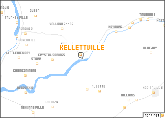
Kellettville (Pennsylvania, United States - USA)Kellettville is a town in the Pennsylvania region of United States - USA. An overview map of the region around Kellettville is displayed below.
regional and 3d topo map of Kellettville, United States - USA ::
Kellettville airports ::
The nearest airport is YNG - Youngstown Warren Rgnl, located 122.0 km west of Kellettville.
Other airports nearby include PIT - Pittsburgh (pennsylva) Pittsburgh Intl (141.8 km south west), AOO - Altoona Blair Co (159.3 km south east), BUF - Buffalo Niagara Intl (161.9 km north), IAG - Niagara Falls Intl (176.3 km north), Nearby towns ::
Whig Hill (3.5km north west) //
Crystal Springs (5.2km west) //
Guitonville (7.0km south) //
Muzette (7.8km south) //
Yellow Hammer (7.7km north west) //
Mayburg (8.4km north east) //
[all distances 'as the bird flies' and approximate]  Places with similar names to Kellettville, United States - USA ::
// Goldville (US)
// Col di Villa (IT)
// Cale da Vila (PT)
// Gløtvola (NO)
// Coldău-Vale (RO)
// Caldevilla (ES)
// Caldevilla (ES)
// Caldevilla (ES)
// Gouldville (ZA)
// Clydevale (NZ)
Disclaimer :: Information on this page comes without warranty of any kind |
||
|
Where is Kellettville? Elevation and coordinates ::
Latitude (lat): 41°32'17"N Longitude (lon): 79°16'5"W
Elevation (approx.): 376m (map arrows pan, magnifying glasses zoom) |
||
|
Visiting Kellettville? Hotel/Accommodation ::
Book a hotel in Kellettville Travel Guide ::
rental cars ::
car rental offers GPS waypoint ::
download a GPX waypoint (PoI) of Kellettville for your GPS receiver
|
||