|
search place name
|
||
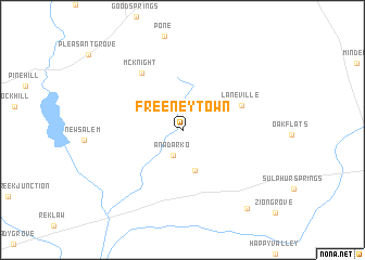
Freeneytown (Texas, United States - USA)Freeneytown is a town in the Texas region of United States - USA. An overview map of the region around Freeneytown is displayed below.
regional and 3d topo map of Freeneytown, United States - USA ::
Freeneytown airports ::
The nearest airport is GGG - Longview East Texas Rgnl, located 50.2 km north of Freeneytown.
Other airports nearby include TYR - Tyler Pounds Rgnl (67.3 km north west), SHV - Shreveport Rgnl (112.6 km north east), BAD - Shreveport Barksdale Afb (129.0 km north east), CXO - Conroe Lone Star Executive (184.8 km south), Nearby towns ::
Anadarko (2.7km south) //
Glenfawn (4.3km south) //
Laneville (5.7km north east) //
McKnight (6.9km north west) //
Valley Grove (9.8km south east) //
[all distances 'as the bird flies' and approximate]  Places with similar names to Freeneytown, United States - USA ::
// Fiorentino (IT)
// Frontin (IT)
// Frandina (PT)
// Verendin (RO)
// Frontón (ES)
// Fronton (US)
// Frontino (CO)
// Frantin (GH)
// Fiarine Diana (SN)
// Varandān (IR)
Disclaimer :: Information on this page comes without warranty of any kind |
||
|
Where is Freeneytown? Elevation and coordinates ::
Latitude (lat): 31°57'5"N Longitude (lon): 94°52'5"W
Elevation (approx.): 114m (map arrows pan, magnifying glasses zoom) |
||
|
Visiting Freeneytown? Hotel/Accommodation ::
Book a hotel in Freeneytown Travel Guide ::
rental cars ::
car rental offers GPS waypoint ::
download a GPX waypoint (PoI) of Freeneytown for your GPS receiver
|
||