|
search place name
|
||
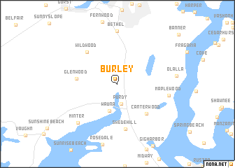
Burley (Washington, United States - USA)Burley is a town in the Washington region of United States - USA. An overview map of the region around Burley is displayed below.
regional and 3d topo map of Burley, United States - USA ::
Burley airports ::
The nearest airport is SEA - Seattle Tacoma Intl, located 24.4 km east of Burley.
Other airports nearby include BFI - Seattle Boeing Fld King Co Intl (27.7 km north east), TCM - Tacoma Mc Chord Afb (33.3 km south), GRF - Fort Lewis Gray Aaf (37.9 km south), PAE - Everett Snohomish Co (60.3 km north east), Nearby towns ::
Purdy (3.2km south) //
Wauna (4.4km south) //
Glenwood (4.5km west) //
Canterwood (5.7km south east) //
Wildwood (6.1km north west) //
Swede Hill (7.3km south) //
Maplewood (5.8km east) //
Bethel (8.5km north) //
Minter (7.5km south west) //
[all distances 'as the bird flies' and approximate] 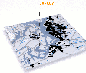 Places with similar names to Burley, United States - USA ::
Disclaimer :: Information on this page comes without warranty of any kind |
||
|
Where is Burley? Elevation and coordinates ::
Latitude (lat): 47°25'5"N Longitude (lon): 122°37'47"W
Elevation (approx.): 10m (map arrows pan, magnifying glasses zoom) |
||
|
Visiting Burley? Hotel/Accommodation ::
Book a hotel in Burley Travel Guide ::
rental cars ::
car rental offers GPS waypoint ::
download a GPX waypoint (PoI) of Burley for your GPS receiver
|
||