|
search place name
|
||
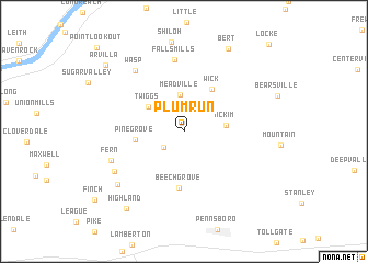
Plum Run (West Virginia, United States - USA)Plum Run is a town in the West Virginia region of United States - USA. An overview map of the region around Plum Run is displayed below.
regional and 3d topo map of Plum Run, United States - USA ::
Plum Run airports ::
The nearest airport is EKN - Elkins Randolph Co Jennings Randolph, located 112.5 km south east of Plum Run.
Other airports nearby include PIT - Pittsburgh (pennsylva) Pittsburgh Intl (140.3 km north east), LCK - Columbus Rickenbacker Intl (172.6 km west), CMH - Port Columbus Intl (176.4 km north west), AKR - Akron Fulton Intl (188.9 km north), Nearby towns ::
Hebron (2.3km south west) //
Meadville (3.8km north) //
McKim (3.4km east) //
Twiggs (3.8km north west) //
Pine Grove (3.9km west) //
Wick (4.8km north east) //
Beech Grove (5.8km south) //
Falls Mills (7.4km north) //
Wasp (7.2km north west) //
Fern (6.5km south west) //
Adlai (6.8km south west) //
Briggs (7.6km south west) //
Bert (9.2km north) //
Highland (9.1km south west) //
Arvilla (9.1km north west) //
Locke (11.1km north east) //
[all distances 'as the bird flies' and approximate] 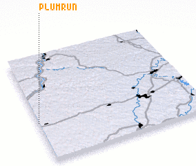 Places with similar names to Plum Run, United States - USA ::
// Plum Run (US)
// Palaiomoírion (GR)
// Palamárion (GR)
// Palamárion (GR)
// Plomárion (GR)
// Plum Run (US)
// Pelamburan (ID)
// Palmarin (SN)
// Palmerani (PE)
// Palmeirina (BR)
Disclaimer :: Information on this page comes without warranty of any kind |
||
|
Where is Plum Run? Elevation and coordinates ::
Latitude (lat): 39°22'29"N Longitude (lon): 80°59'59"W
Elevation (approx.): 257m (map arrows pan, magnifying glasses zoom) |
||
|
Visiting Plum Run? Hotel/Accommodation ::
Book a hotel in Plum Run Travel Guide ::
rental cars ::
car rental offers GPS waypoint ::
download a GPX waypoint (PoI) of Plum Run for your GPS receiver
|
||