|
search place name
|
||
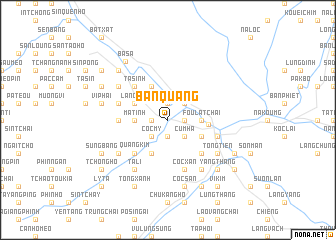
Bản Quang (Vietnam)Bản Quang is a town in Vietnam. An overview map of the region around Bản Quang is displayed below.
regional and 3d topo map of Bản Quang, Vietnam ::
Bản Quang airports ::
The nearest airport is HAN - Hanoi Noibai Intl, located 242.4 km south east of Bản Quang.
Nearby towns ::
Lung Hang (1.9km north) //
Côc Sa (1.7km east) //
Nhat Son (1.7km west) //
Bàn Kiang (1.7km west) //
Muong Xan (1.9km south) //
Pac San (2.5km north east) //
Cum Hạ (2.5km south east) //
Làng Kim (2.5km south west) //
Côc My (2.5km south west) //
Fou La Tchai (3.4km east) //
Ma Tinh (3.4km west) //
Bản Lang (3.4km west) //
Na Bon (4.1km north west) //
Dong Phan (4.1km north west) //
Sơn Ðen (3.9km south east) //
Làng Nang (3.9km north west) //
Làng Tan (3.9km north west) //
Bac Van (4.1km south west) //
Hekou (4.2km east) //
Na Loc (5.0km north west) //
Ta Sinh (5.0km north west) //
Lào Cai (5.0km south east) //
Quang Kim (5.0km south west) //
Bản Kiang Sui Tao (5.1km west) //
Bản Vài (5.5km west) //
Dồng Tuyền (5.8km south) //
Coc Xan (5.8km south) //
Cốc Lếu (5.5km east) //
Cốc Phuc (6.3km north west) //
[all distances 'as the bird flies' and approximate] 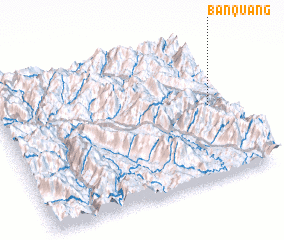 Places with similar names to Bản Quang, Vietnam ::
// Ban Kang (LA)
// Banakang (PH)
// Bangong (PH)
// Binguang (PH)
// Bincong (PH)
// Benking (AT)
// Ban A Kiang (TH)
// Ban Ao Kung (TH)
// Ban Kaeng (TH)
// Ban Kaeng (TH)
Disclaimer :: Information on this page comes without warranty of any kind |
||
|
Where is Bản Quang? Elevation and coordinates ::
Latitude (lat): 22°31'0"N Longitude (lon): 103°55'0"E
Elevation (approx.): 132m (map arrows pan, magnifying glasses zoom) |
||
|
Visiting Bản Quang? Hotel/Accommodation ::
Book a hotel in Bản Quang Travel Guide ::
Buy a travel guide for Vietnam rental cars ::
car rental offers GPS waypoint ::
download a GPX waypoint (PoI) of Bản Quang for your GPS receiver
|
||