|
search place name
|
||
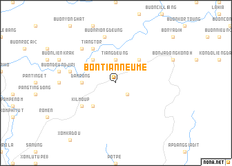
Bon Tian Neume (Lâm Ðồng, Vietnam)Bon Tian Neume is a town in the Lâm Ðồng region of Vietnam. An overview map of the region around Bon Tian Neume is displayed below.
regional and 3d topo map of Bon Tian Neume, Vietnam ::
Bon Tian Neume airports ::
The nearest airport is NHA - Nhatrang, located 97.5 km east of Bon Tian Neume.
Other airports nearby include SGN - Ho Chi Minh City Tansonnhat Intl (232.4 km south west), Nearby towns ::
Buôn Treun (2.6km south east) //
Tiang Deung (3.7km north) //
Buôn Young (5.2km north west) //
Buôn Chill Deunn (5.2km north west) //
Buôn Lieng Trang (5.2km south west) //
Bon Deung Trang (5.2km north east) //
Ðam Rong (5.4km west) //
Bon Da R'hâu (5.4km west) //
Tiang Tör (6.6km north west) //
Kil Moup (6.6km south west) //
Bon Da M'rong (7.5km west) //
Buôn Riong Deung (7.6km north) //
Buôn R'liêng (7.8km north west) //
[all distances 'as the bird flies' and approximate]  Places with similar names to Bon Tian Neume, Vietnam ::
// Ban Chao Nam (TH)
// Ban Chanam (LA)
// Ban Chan-Mai (LA)
// Ban Chanmai (LA)
// Ban Chanmai (LA)
Disclaimer :: Information on this page comes without warranty of any kind |
||
|
Where is Bon Tian Neume? Elevation and coordinates ::
Latitude (lat): 12°9'0"N Longitude (lon): 108°18'0"E
Elevation (approx.): 803m (map arrows pan, magnifying glasses zoom) |
||
|
Visiting Bon Tian Neume? Hotel/Accommodation ::
Book a hotel in Bon Tian Neume Travel Guide ::
Buy a travel guide for Vietnam rental cars ::
car rental offers GPS waypoint ::
download a GPX waypoint (PoI) of Bon Tian Neume for your GPS receiver
|
||