|
search place name
|
||
Buôn Treun (Lâm Ðồng, Vietnam)Buôn Treun is a town in the Lâm Ðồng region of Vietnam. An overview map of the region around Buôn Treun is displayed below.
regional and 3d topo map of Buôn Treun, Vietnam ::

Buôn Treun airports ::
The nearest airport is NHA - Nhatrang, located 95.9 km east of Buôn Treun.
Other airports nearby include SGN - Ho Chi Minh City Tansonnhat Intl (232.7 km south west), Nearby towns ::
Bon Tian Neume (2.6km north west) //
Buôn Lieng Trang (5.7km west) //
Bon Deung Trang (5.8km north) //
Tiang Deung (5.8km north) //
Kil Moup (7.5km west) //
Bon Da R'hâu (7.5km west) //
Ðam Rong (7.5km west) //
Buôn Chill Deunn (7.8km north west) //
Buôn Young (7.8km north west) //
Bonja Dơng Kơnơh (9.1km north east) //
Tiang Tör (9.2km north west) //
Buôn R'liêng (10.4km north west) //
[all distances 'as the bird flies' and approximate] 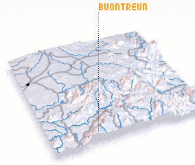 Places with similar names to Buôn Treun, Vietnam ::
// Bantaron (PH)
// Ban Na Tron (TH)
// Ban Na Tron (TH)
// Bondarnyy (UA)
// Bandrany (MG)
// Bondārān (IR)
// Bantaran (ID)
// Bontoranu (ID)
// Bandarini (TZ)
// Bānda Rāīn (PK)
Disclaimer :: Information on this page comes without warranty of any kind |
||
|
Where is Buôn Treun? Elevation and coordinates ::
Latitude (lat): 12°8'0"N Longitude (lon): 108°19'0"E
Elevation (approx.): 1167m (map arrows pan, magnifying glasses zoom) |
||
|
Visiting Buôn Treun? Hotel/Accommodation ::
Book a hotel in Buôn Treun Travel Guide ::
Buy a travel guide for Vietnam rental cars ::
car rental offers GPS waypoint ::
download a GPX waypoint (PoI) of Buôn Treun for your GPS receiver
|
||