|
search place name
|
||
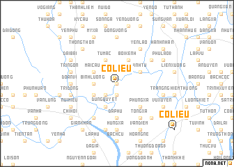
Cổ Liêu (Vietnam)Cổ Liêu is a town in Vietnam. An overview map of the region around Cổ Liêu is displayed below.
regional and 3d topo map of Cổ Liêu, Vietnam ::
Cổ Liêu airports ::
The nearest airport is HAN - Hanoi Noibai Intl, located 94.6 km north of Cổ Liêu.
Nearby towns ::
Mai Ðộ (0.0km north) //
Vô Vọng (1.9km south) //
Lạc Chính (2.5km south west) //
Bình Lượng (3.5km west) //
Kênh Thanh (3.9km south west) //
Dũng Quyết (4.1km south west) //
Chuyêt Cầu (3.9km north west) //
Mai Cầu (3.9km north west) //
Tử Mãc (4.1km north west) //
Tri Chuật (4.1km north west) //
Bối Kênh (4.1km north east) //
Vinh Tứ (3.9km north east) //
Bình Diền (3.9km north east) //
Phùng Xá (5.1km south east) //
Ða Phú (5.6km south) //
Cung Quế (6.6km south west) //
Duyên Trường (6.4km north east) //
Thiêm Lộc (6.6km south east) //
Thứ Nhất (6.6km north east) //
Tieu Dong (6.6km north east) //
Tống Xá (6.6km south east) //
Yên Lão (6.6km north east) //
Hưng Xá (7.4km south) //
Ðoan Vĩ (6.9km west) //
Ðống Vọng (7.4km north) //
Giáp Giá (7.6km south) //
Trì Ðộng (7.2km west) //
Tri Ngôn (7.2km west) //
Thien My (7.2km east) //
[all distances 'as the bird flies' and approximate]  Places with similar names to Cổ Liêu, Vietnam ::
Disclaimer :: Information on this page comes without warranty of any kind |
||
|
Where is Cổ Liêu? Elevation and coordinates ::
Latitude (lat): 20°23'0"N Longitude (lon): 105°59'0"E
Elevation (approx.): 4m (map arrows pan, magnifying glasses zoom) |
||
|
Visiting Cổ Liêu? Hotel/Accommodation ::
Book a hotel in Cổ Liêu Travel Guide ::
Buy a travel guide for Vietnam rental cars ::
car rental offers GPS waypoint ::
download a GPX waypoint (PoI) of Cổ Liêu for your GPS receiver
|
||