|
search place name
|
||
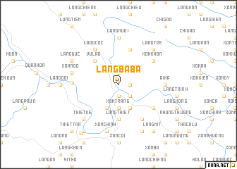
Làng Bà Bá (Thanh Hóa, Vietnam)Làng Bà Bá is a town in the Thanh Hóa region of Vietnam. An overview map of the region around Làng Bà Bá is displayed below.
regional and 3d topo map of Làng Bà Bá, Vietnam ::
Làng Bà Bá airports ::
The nearest airport is HAN - Hanoi Noibai Intl, located 112.8 km north east of Làng Bà Bá.
Nearby towns ::
Ngoại Sa (1.7km east) //
Làng Chiên (2) (1.7km east) //
Xóm Ba (2) (1.9km north) //
La Hán (1.9km south) //
Làng Cánh Nàn (1.9km south) //
Xóm Mân (2.5km south east) //
Xóm Trang (3.7km south) //
Lâm Sa (4.1km south east) //
Làng Cã (4.1km south west) //
Vũ Lao (5.1km north west) //
Làng Thiết (5.6km south) //
Làng Diêu (5.8km north) //
Xóm Khon (6.4km north east) //
Làng Lông (6.6km south east) //
Ải Thượng (6.4km south east) //
Làng Coc (6.6km north west) //
Phú Nghiêm (6.8km west) //
Ải Hạ (6.9km east) //
Làng Mươi (7.4km north) //
Xóm Ngô (7.2km west) //
Xóm Chính (7.6km south) //
Làng Tre (7.6km north east) //
Thiết Kế (7.6km south west) //
Làng Hạ (8.2km south east) //
Làng Ðuc (7.9km north west) //
Làng Mit (9.1km south east) //
Làng Trong (9.1km south west) //
Hương Bá Thước (9.6km south west) //
Thiết Trà (10.2km south west) //
[all distances 'as the bird flies' and approximate] 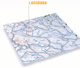 Places with similar names to Làng Bà Bá, Vietnam ::
Disclaimer :: Information on this page comes without warranty of any kind |
||
|
Where is Làng Bà Bá? Elevation and coordinates ::
Latitude (lat): 20°22'0"N Longitude (lon): 105°13'0"E
Elevation (approx.): 61m (map arrows pan, magnifying glasses zoom) |
||
|
Visiting Làng Bà Bá? Hotel/Accommodation ::
Book a hotel in Làng Bà Bá Travel Guide ::
Buy a travel guide for Vietnam rental cars ::
car rental offers GPS waypoint ::
download a GPX waypoint (PoI) of Làng Bà Bá for your GPS receiver
|
||