|
search place name
|
||
Lang Boa (1) (Vietnam)Lang Boa (1) is a town in Vietnam. An overview map of the region around Lang Boa (1) is displayed below.
regional and 3d topo map of Lang Boa (1), Vietnam ::

Lang Boa (1) airports ::
The nearest airport is DAD - Danang Intl, located 104.0 km north of Lang Boa (1).
Nearby towns ::
Moo (4.1km south east) //
Gogao (6.6km south west) //
Xã Trương (1) (7.4km east) //
Go Tro (7.6km south) //
Gò Vi (2) (7.7km south east) //
Wi Kin (8.2km south east) //
Làng Nuit (8.1km south west) //
Cầu Nguyên (8.1km south east) //
Hoàn Lộc (1) (8.1km south east) //
Trịnh Nguyên (1) (8.1km south east) //
Wi Baise (1) (9.2km south east) //
Hà Thành (9.1km south east) //
Trà Sơn (10.3km north east) //
Cha Chu (10.3km north east) //
Ruộng Viên (10.3km south east) //
Xã Ky Mao (1) (10.3km south east) //
Bayado (10.3km south west) //
[all distances 'as the bird flies' and approximate] 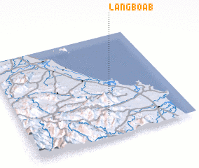 Places with similar names to Lang Boa (1), Vietnam ::
Disclaimer :: Information on this page comes without warranty of any kind |
||
|
Where is Lang Boa (1)? Elevation and coordinates ::
Latitude (lat): 15°9'0"N Longitude (lon): 108°30'0"E
Elevation (approx.): 435m (map arrows pan, magnifying glasses zoom) |
||
|
Visiting Lang Boa (1)? Hotel/Accommodation ::
Book a hotel in Lang Boa (1) Travel Guide ::
Buy a travel guide for Vietnam rental cars ::
car rental offers GPS waypoint ::
download a GPX waypoint (PoI) of Lang Boa (1) for your GPS receiver
|
||