|
search place name
|
||
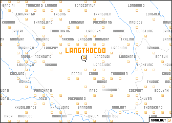
Làng Thốc Ðo (Cao Bằng, Vietnam)Làng Thốc Ðo is a town in the Cao Bằng region of Vietnam. An overview map of the region around Làng Thốc Ðo is displayed below.
regional and 3d topo map of Làng Thốc Ðo, Vietnam ::
Làng Thốc Ðo airports ::
The nearest airport is HAN - Hanoi Noibai Intl, located 180.3 km south of Làng Thốc Ðo.
Other airports nearby include NNG - Nanning Wuxu (200.4 km east), Nearby towns ::
Lủng Pỏ (1.9km north) //
Kéo Khao (1.9km south) //
Khôn Sà (2.5km north east) //
Làng Tao (2.5km south east) //
Làng Sỏm (3.7km north) //
Làng Rọt (3.4km east) //
Làng Rượi (3.4km east) //
Lung Khoen (4.1km north west) //
Nà Nấm (4.1km south west) //
Lạc Giển (4.1km north east) //
Ca Rài (4.1km south east) //
Làng Giước (3.9km south east) //
Ma Rảng (5.0km north west) //
Nà Gà (5.0km south west) //
Nặm Goằm (5.0km north east) //
BácLục (5.0km south east) //
Khuổi Khoáng (5.6km south) //
Ca Pắng (5.6km north) //
Làng Pàn (5.4km east) //
Chắm Ché Húa (5.4km west) //
Làng Nặm (5.8km north) //
Làng Nung (6.3km north west) //
Lũng Ngươm (6.3km south east) //
Nà Mấn (6.5km south east) //
Khuổi Ðăm (6.5km south east) //
Làng Bua (7.1km west) //
Làng Rầy (7.1km west) //
Nà Bản (7.1km west) //
Nà Khan (7.1km west) //
[all distances 'as the bird flies' and approximate]  Places with similar names to Làng Thốc Ðo, Vietnam :: Disclaimer :: Information on this page comes without warranty of any kind |
||
|
Where is Làng Thốc Ðo? Elevation and coordinates ::
Latitude (lat): 22°48'0"N Longitude (lon): 106°14'0"E
Elevation (approx.): 869m (map arrows pan, magnifying glasses zoom) |
||
|
Visiting Làng Thốc Ðo? Hotel/Accommodation ::
Book a hotel in Làng Thốc Ðo Travel Guide ::
Buy a travel guide for Vietnam rental cars ::
car rental offers GPS waypoint ::
download a GPX waypoint (PoI) of Làng Thốc Ðo for your GPS receiver
|
||