|
search place name
|
||
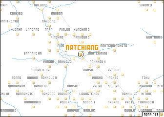
Na Tchiang (Vietnam)Na Tchiang is a town in Vietnam. An overview map of the region around Na Tchiang is displayed below.
regional and 3d topo map of Na Tchiang, Vietnam ::
Nearby towns ::
Na Pao (0.0km north) //
Thân Thuộc (0.0km north) //
Cham Ka (1.9km north) //
Huổi Luông (1.9km north) //
Na Ban (1.7km west) //
Na Lao (1.7km west) //
Na Cốc (2.5km north east) //
Ðồng Tát (2.5km south east) //
Chom Chang (2.5km south east) //
Nam Tchiang (3.4km east) //
Nam Koung (3.7km north) //
Na Kai (3.9km north west) //
Nam Pao (3.9km north east) //
Ping Koum (3.9km north west) //
Loung Tap (3.9km north east) //
Nam Louc (3.9km south west) //
Nam Chia (3.9km south west) //
Hủa Cưởng (3.9km south east) //
Nam Khoum (3.9km south east) //
Nậm Sát (4.1km south east) //
Hua Chăng (5.6km north) //
Nam Chia (5.5km west) //
Na Kouang (5.8km north) //
Hô Be Mèo (5.8km north) //
Na Koua (5.8km north) //
Ping Hao (6.3km north west) //
Khê An (6.3km north west) //
Phiêng Phát (6.5km south east) //
Ping Ho (6.5km south east) //
[all distances 'as the bird flies' and approximate]  Places with similar names to Na Tchiang, Vietnam ::
// Natchaung (MM)
// Natchaung (MM)
// Natchaung (MM)
// Natchaung (MM)
// Netchaung (MM)
// Ntshieng (ZA)
// Ntchengué (GA)
// Notchŏng (KR)
// Na Tchoung (VN)
// Niudachang (CN)
Disclaimer :: Information on this page comes without warranty of any kind |
||
|
Where is Na Tchiang? Elevation and coordinates ::
Latitude (lat): 22°10'0"N Longitude (lon): 103°45'0"E
Elevation (approx.): 557m (map arrows pan, magnifying glasses zoom) |
||
|
Visiting Na Tchiang? Hotel/Accommodation ::
Book a hotel in Na Tchiang Travel Guide ::
Buy a travel guide for Vietnam rental cars ::
car rental offers GPS waypoint ::
download a GPX waypoint (PoI) of Na Tchiang for your GPS receiver
|
||