|
search place name
|
||
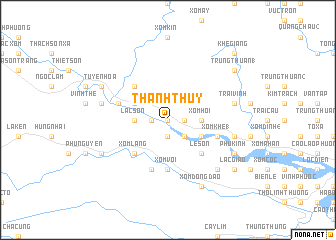
Thanh Thủy (Vietnam)Thanh Thủy is a town in Vietnam. An overview map of the region around Thanh Thủy is displayed below.
regional and 3d topo map of Thanh Thủy, Vietnam ::
Thanh Thủy airports ::
The nearest airport is ZVK - Savannakhet, located 208.6 km south west of Thanh Thủy.
Other airports nearby include DAD - Danang Intl (285.7 km south east), Nearby towns ::
Lam Lang (0.0km north) //
Xóm Trúc (0.0km north) //
Xuân Mai (1.8km west) //
Xóm Khiên (1.8km east) //
Xóm Làng (1.8km east) //
Kinh Thanh (1.9km south) //
Xóm Cồn (2.6km south east) //
Kinh Châu (2.6km south east) //
Lạc Sơn (3.5km west) //
Xóm Hoi (3.5km east) //
Gồ Cào Bắc (4.0km north west) //
Hà Công (4.0km south east) //
Cương Gián (4.0km south east) //
Minh Cầm (5.1km north west) //
Xóm Lang (5.1km south west) //
Xóm Chùa (5.1km south west) //
Lễ Sơn (5.1km south east) //
Xóm Voi (5.6km south) //
Cao Mại (2) (5.8km south) //
Xóm Gát (5.8km south) //
Cổ Cảng (5.6km west) //
Xóm Khe (1) (5.6km east) //
Cho Phong (7.3km west) //
Trại Vĩnh (7.3km east) //
Mỹ Cương (7.3km east) //
Kinh Nhuận (7.3km east) //
Hạ Trang (7.7km south east) //
Tuyên Hóa (8.0km north west) //
Tang Ngoại (8.0km north west) //
[all distances 'as the bird flies' and approximate]  Places with similar names to Thanh Thủy, Vietnam ::
// Thantha (MM)
// Thanthe (MM)
// Thinthi (MM)
// Thành Th (VN)
// Thành Thới (VN)
// Thanh Thù (VN)
// Thanh Thủy (VN)
// Thanh Thủy (VN)
// Thanh Thủy (VN)
// Thèn Thầu (VN)
Disclaimer :: Information on this page comes without warranty of any kind |
||
|
Where is Thanh Thủy? Elevation and coordinates ::
Latitude (lat): 17°48'0"N Longitude (lon): 106°14'0"E
Elevation (approx.): 10m (map arrows pan, magnifying glasses zoom) |
||
|
Visiting Thanh Thủy? Hotel/Accommodation ::
Book a hotel in Thanh Thủy Travel Guide ::
Buy a travel guide for Vietnam rental cars ::
car rental offers GPS waypoint ::
download a GPX waypoint (PoI) of Thanh Thủy for your GPS receiver
|
||