|
search place name
|
||
Thèn Thầu (Lai Châu, Vietnam)Thèn Thầu is a town in the Lai Châu region of Vietnam. An overview map of the region around Thèn Thầu is displayed below.
regional and 3d topo map of Thèn Thầu, Vietnam ::
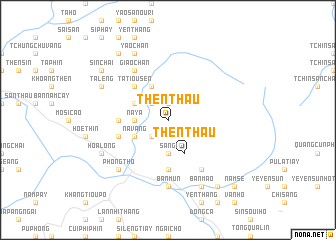
Nearby towns ::
Na Giang (1.9km north) //
Sàng Dêng (2.5km south west) //
Na Cúng (2.5km north west) //
San Gì (3.7km south) //
Na Ya (3.4km west) //
Na Vang (3.9km south west) //
Then Thầu (4.1km south east) //
Bản Lang (3.9km north west) //
Sì Tháu Chải (4.1km north west) //
Ta Tiou Sen (5.0km north west) //
Ngài Chồ (5.6km south) //
Ho Sao Chải (5.1km west) //
Nàm Cáy (5.5km west) //
Pho Chà (6.5km south east) //
Giao Chản (6.5km north west) //
Bản Mứn (7.4km south) //
Phong Thổ (7.6km south west) //
Bản Mao (8.2km south east) //
Hoa Long (7.8km south west) //
Yao Chản (8.2km north west) //
Ta Leng (7.8km north west) //
Pin Thậu Chải (7.8km north west) //
Khon To (9.0km south east) //
Sin Chải (8.8km north west) //
Là Sui Chai (9.0km north west) //
Nam Se (10.1km south east) //
[all distances 'as the bird flies' and approximate]  Places with similar names to Thèn Thầu, Vietnam ::
// Thantha (MM)
// Thanthe (MM)
// Thinthi (MM)
// Thành Th (VN)
// Thành Thới (VN)
// Thanh Thù (VN)
// Thanh Thủy (VN)
// Thanh Thủy (VN)
// Thanh Thủy (VN)
// Thanh Thủy (VN)
Disclaimer :: Information on this page comes without warranty of any kind |
||
|
Where is Thèn Thầu? Elevation and coordinates ::
Latitude (lat): 22°35'0"N Longitude (lon): 103°24'0"E
Elevation (approx.): 598m (map arrows pan, magnifying glasses zoom) |
||
|
Visiting Thèn Thầu? Hotel/Accommodation ::
Book a hotel in Thèn Thầu Travel Guide ::
Buy a travel guide for Vietnam rental cars ::
car rental offers GPS waypoint ::
download a GPX waypoint (PoI) of Thèn Thầu for your GPS receiver
|
||