|
search place name
|
||
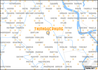
Thịnh Ðức Phùng (Vietnam)Thịnh Ðức Phùng is a town in Vietnam. An overview map of the region around Thịnh Ðức Phùng is displayed below.
regional and 3d topo map of Thịnh Ðức Phùng, Vietnam ::
Thịnh Ðức Phùng airports ::
The nearest airport is HAN - Hanoi Noibai Intl, located 58.0 km north of Thịnh Ðức Phùng.
Nearby towns ::
Thịnh Dức Thần (1.7km east) //
Bối Khê (1.9km north) //
Xóm Ðình (2.5km south east) //
Chuyên Mỹ Trung (4.1km north east) //
Quan Tự (4.1km south west) //
Tư Can (3.9km south east) //
Trầm Lộng (3.9km south west) //
Khánh Vân (3.9km north west) //
Thanh Hội (3.9km north west) //
Ngọc Trúc (5.1km south east) //
Xuân Bay (5.1km south west) //
Dũng Cảm (5.1km north west) //
Quất Lâm (5.2km west) //
Ðào Xá (5.6km south) //
Kim Giang (5.6km south) //
Già Cầu (5.8km north) //
Quáng Tái Thượng (5.5km west) //
Mỹ Lâm (6.4km north east) //
Kim Lũng (6.6km north west) //
Co Trai (6.9km east) //
Bạch Sam (7.2km east) //
Trí Thủy (7.2km east) //
Khả Liễu (7.2km east) //
Nhật Tựu (7.6km south) //
Xóm Ngoài (7.2km west) //
Hoàng Hạ (7.6km north) //
Ðông Dương (7.2km west) //
Nam Quất (7.6km north east) //
Ninh Lão (7.6km south east) //
[all distances 'as the bird flies' and approximate] 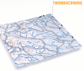 Places with similar names to Thịnh Ðức Phùng, Vietnam :: Disclaimer :: Information on this page comes without warranty of any kind |
||
|
Where is Thịnh Ðức Phùng? Elevation and coordinates ::
Latitude (lat): 20°42'0"N Longitude (lon): 105°52'0"E
Elevation (approx.): 5m (map arrows pan, magnifying glasses zoom) |
||
|
Visiting Thịnh Ðức Phùng? Hotel/Accommodation ::
Book a hotel in Thịnh Ðức Phùng Travel Guide ::
Buy a travel guide for Vietnam rental cars ::
car rental offers GPS waypoint ::
download a GPX waypoint (PoI) of Thịnh Ðức Phùng for your GPS receiver
|
||