|
search place name
|
||
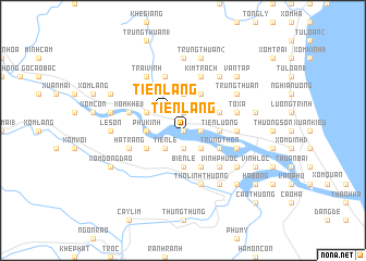
Tiên Lang (Vietnam)Tiên Lang is a town in Vietnam. An overview map of the region around Tiên Lang is displayed below.
regional and 3d topo map of Tiên Lang, Vietnam ::
Tiên Lang airports ::
The nearest airport is ZVK - Savannakhet, located 214.4 km south west of Tiên Lang.
Other airports nearby include DAD - Danang Intl (275.4 km south east), Nearby towns ::
Cồn Cưởi (0.0km north) //
Xóm Phan (0.0km north) //
Xóm Ðình (4) (1.9km north) //
Cồn Ngựa (1.8km east) //
Cồn Quan (1.9km south) //
Xóm Cốc (1.9km south) //
Tiên Lang (2.6km north west) //
Tiên Lễ (2.6km south west) //
Thượng Thộn (2.6km south east) //
Trại Cau (3.7km north) //
Phù Kinh (3.5km west) //
Tiên Lương (3.5km east) //
Biện Lệ (3.7km south) //
Mỹ Cương (4.0km north west) //
Kinh Nhuận (4.0km north west) //
Trung Tân (4.1km north east) //
Lạc Giao (4.0km south west) //
Hương Phương (4.0km north east) //
Trung Thôn (4.0km south east) //
Lâm Xuân (4.1km south east) //
Riệng Thượng (5.1km south east) //
Vinh Phước (5.1km south east) //
Cao Lao Phường (5.3km east) //
Tô Xá (5.6km east) //
Trại Sim (5.8km north) //
Xóm Khe (1) (5.6km west) //
Thọ Linh Hạ (5.8km south) //
Thọ Linh Thượng (5.8km south) //
Lộc Ðiền (5.6km east) //
[all distances 'as the bird flies' and approximate] 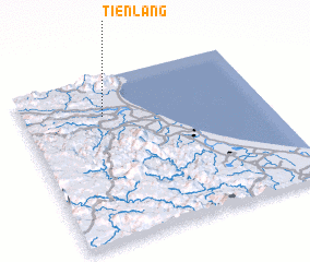 Places with similar names to Tiên Lang, Vietnam ::
// Danilenki (RU)
// Tai'anling (CN)
// T'ien-leng (TW)
// Ðình Làng (VN)
// Ðôn Lương (VN)
// Dồn Lưống (VN)
// Tanolang (PH)
// Tanolong (PH)
// Tân Long (VN)
// Tân Long (VN)
Disclaimer :: Information on this page comes without warranty of any kind |
||
|
Where is Tiên Lang? Elevation and coordinates ::
Latitude (lat): 17°46'0"N Longitude (lon): 106°20'0"E
(map arrows pan, magnifying glasses zoom) |
||
|
Visiting Tiên Lang? Hotel/Accommodation ::
Book a hotel in Tiên Lang Travel Guide ::
Buy a travel guide for Vietnam rental cars ::
car rental offers GPS waypoint ::
download a GPX waypoint (PoI) of Tiên Lang for your GPS receiver
|
||