|
search place name
|
||
Trúc Hạ (Vietnam)Trúc Hạ is a town in Vietnam. An overview map of the region around Trúc Hạ is displayed below.
regional and 3d topo map of Trúc Hạ, Vietnam ::

Trúc Hạ airports ::
The nearest airport is SNO - Sakon Nakhon, located 257.6 km south west of Trúc Hạ.
Nearby towns ::
Làng Ngọc Khê (0.0km north) //
Ðồng Ðûc (1.9km south) //
Thọ Trường (2.5km south east) //
Thọ Bằng (2.5km south east) //
Yên Do (3.5km east) //
Phúc Thạch (3.5km east) //
Lạc Thọ (3.7km south) //
Yên Mã (3.7km south) //
Long Cơ (2) (4.1km north east) //
Ðồng Nhân (4.1km south east) //
Yên Hâu (5.1km north east) //
Xóm Rừm (5.1km north east) //
Xóm Sôi (5.1km north east) //
Mâc Táo (5.1km north east) //
Ðồng Xuân (5.1km north east) //
Cao Hậu Ðoài (5.3km east) //
Qui Lăng (5.6km south) //
Du Xương (5.8km north) //
Lạc Thiện (5.8km south) //
Trai Ðồng Nông (5.8km north) //
Nhân Trạch (6.6km south east) //
Trung Thượng (6.6km south east) //
Cẩm Bào (7.0km east) //
Xóm Bầu Chi (7.0km east) //
Xóm Nam (2) (7.4km south) //
Phúc Tập (7.4km south) //
Yên Lý Ðông (7.2km east) //
Yên Lý Thượng (7.2km east) //
Tiên Bồng (7.6km south) //
[all distances 'as the bird flies' and approximate] 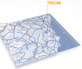 Places with similar names to Trúc Hạ, Vietnam ::
// Tercia (BO)
// Douar Aouaoucha (MA)
// Douar Chaouia (MA)
// Douar Chaouia (MA)
// Douar Chaouia (MA)
// Driouch (MA)
// Tarcha (RU)
// Trosh (RU)
// Trysh (RU)
// Turachi (RU)
Disclaimer :: Information on this page comes without warranty of any kind |
||
|
Where is Trúc Hạ? Elevation and coordinates ::
Latitude (lat): 19°6'0"N Longitude (lon): 105°31'0"E
Elevation (approx.): 10m (map arrows pan, magnifying glasses zoom) |
||
|
Visiting Trúc Hạ? Hotel/Accommodation ::
Book a hotel in Trúc Hạ Travel Guide ::
Buy a travel guide for Vietnam rental cars ::
car rental offers GPS waypoint ::
download a GPX waypoint (PoI) of Trúc Hạ for your GPS receiver
|
||