|
search place name
|
||
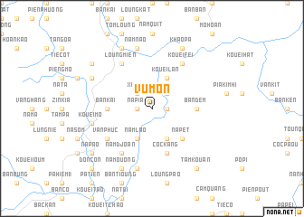
Vu Mon (Bắc Thái, Vietnam)Vu Mon is a town in the Bắc Thái region of Vietnam. An overview map of the region around Vu Mon is displayed below.
regional and 3d topo map of Vu Mon, Vietnam ::
Vu Mon airports ::
The nearest airport is HAN - Hanoi Noibai Intl, located 114.9 km south of Vu Mon.
Nearby towns ::
Tioc Vèn (1.7km east) //
Done Con (1.7km east) //
Na Pia (1.7km west) //
Na Kouang (2.5km north east) //
Cao Kouom (2.5km north west) //
Xi Binh (2.5km north west) //
Loung Xien (4.1km south east) //
Nam Lao (4.1km south west) //
Kouei Lan (4.1km north east) //
Na Pet (5.1km south east) //
Bản Dem (5.1km east) //
Bản Kai (5.1km west) //
Coc Kang (5.8km south) //
Van Phuc (6.3km south west) //
Kouei Fei (6.5km north east) //
Loung Mien (6.5km north west) //
Nam Djoan (6.5km south west) //
Kouei Mo (7.1km west) //
Kouei Doui (7.6km south) //
Nam Nao (7.6km north) //
Khao Pa (8.2km north east) //
Kouei Xanh (7.8km north west) //
Phủ Tong Hóa (7.8km north west) //
Na Mouong (8.2km south west) //
Na Com (8.2km north west) //
Tam Kouan (9.0km south east) //
Co Cou (1) (8.8km north west) //
Na Pao (8.8km south west) //
Don Con (10.1km south west) //
[all distances 'as the bird flies' and approximate]  Places with similar names to Vu Mon, Vietnam ::
Disclaimer :: Information on this page comes without warranty of any kind |
||
|
Where is Vu Mon? Elevation and coordinates ::
Latitude (lat): 22°15'0"N Longitude (lon): 105°57'0"E
Elevation (approx.): 751m (map arrows pan, magnifying glasses zoom) |
||
|
Visiting Vu Mon? Hotel/Accommodation ::
Book a hotel in Vu Mon Travel Guide ::
Buy a travel guide for Vietnam rental cars ::
car rental offers GPS waypoint ::
download a GPX waypoint (PoI) of Vu Mon for your GPS receiver
|
||