|
search place name
|
||
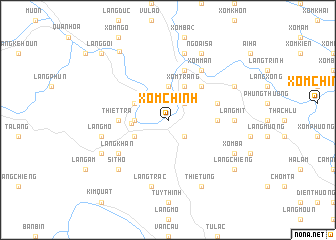
Xóm Chính (Thanh Hóa, Vietnam)Xóm Chính is a town in the Thanh Hóa region of Vietnam. An overview map of the region around Xóm Chính is displayed below.
regional and 3d topo map of Xóm Chính, Vietnam ::
Xóm Chính airports ::
The nearest airport is HAN - Hanoi Noibai Intl, located 120.0 km north east of Xóm Chính.
Nearby towns ::
Làng Thiết (2.5km north east) //
Xóm Cõi (2.5km south east) //
Làng Cã (3.7km north) //
Làng Trong (3.5km west) //
Hương Bá Thước (3.9km west) //
Xóm Trang (4.1km north east) //
Thiết Kế (3.9km north west) //
Xóm Chiền (3.9km south west) //
Lâm Sa (5.1km north east) //
Thiết Trà (5.2km west) //
Làng Hạ (5.2km east) //
Làng Lông (5.5km east) //
Làng Cánh Nàn (5.8km north) //
La Hán (5.8km north) //
Xóm Mân (6.6km north east) //
Làng Khan (6.4km south west) //
Làng Mit (7.0km east) //
Làng Mô (7.2km west) //
Làng Bà Bá (7.6km north) //
Làng Chiền (7.2km west) //
Làng Trac (7.6km south) //
Làng Nước (7.6km south west) //
Sí Thọ (7.6km south west) //
Làng Chiên (2) (8.2km north east) //
Thiết Úng (8.2km south east) //
Ngoại Sa (8.2km north east) //
Ải Thượng (7.9km north east) //
Kỷ Luât (7.9km south west) //
Xóm Bã (7.9km south east) //
[all distances 'as the bird flies' and approximate] 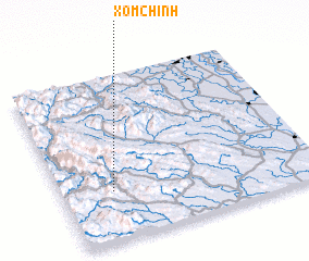 Places with similar names to Xóm Chính, Vietnam ::
// Sumchino (RU)
// Soumésion (GR)
// Śmiecheń (PL)
// Smochan (BG)
// Smychin (UA)
// Zamshany (UA)
// Seh Machān (IR)
// Samch'ŏn-ni (KP)
// Sim-ch'on (KP)
// Simch'ŏn (KP)
Disclaimer :: Information on this page comes without warranty of any kind |
||
|
Where is Xóm Chính? Elevation and coordinates ::
Latitude (lat): 20°18'0"N Longitude (lon): 105°12'0"E
Elevation (approx.): 55m (map arrows pan, magnifying glasses zoom) |
||
|
Visiting Xóm Chính? Hotel/Accommodation ::
Book a hotel in Xóm Chính Travel Guide ::
Buy a travel guide for Vietnam rental cars ::
car rental offers GPS waypoint ::
download a GPX waypoint (PoI) of Xóm Chính for your GPS receiver
|
||