|
search place name
|
||
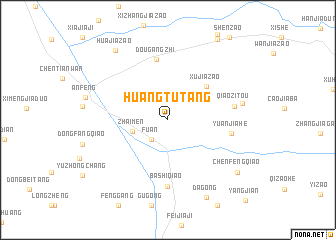
Huangtutang (Jiangsu, China)Huangtutang is a town in the Jiangsu region of China. An overview map of the region around Huangtutang is displayed below.
regional and 3d topo map of Huangtutang, China ::
Huangtutang airports ::
The nearest airport is SHA - Shanghai Hongqiao Intl, located 185.3 km south east of Huangtutang.
Other airports nearby include NKG - Nanjing Lukou (186.3 km south west), Nearby towns ::
Fu'an (2.7km south west) //
Zhaimen (3.6km west) //
Xujiazao (5.2km north east) //
Dougangzhi (6.9km north) //
Yuanjiahe (6.2km east) //
Bashiqiao (7.4km south) //
Qiaozitou (6.4km east) //
Fudong (7.3km east) //
Dagong (9.4km south east) //
Huajiazao (9.2km north west) //
Chenfengqiao (8.8km south east) //
[all distances 'as the bird flies' and approximate] 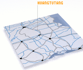 Places with similar names to Huangtutang, China ::
// Hongdae-dong (KP)
// Hŭngdae-dong (KP)
// Hŭngdo-dong (KP)
// Hangdo-dong (KR)
// Hongdo-dong (KP)
// Huangtutang (CN)
Disclaimer :: Information on this page comes without warranty of any kind |
||
|
Where is Huangtutang? Elevation and coordinates ::
Latitude (lat): 32°42'10"N Longitude (lon): 120°29'0"E
Elevation (approx.): 4m (map arrows pan, magnifying glasses zoom) |
||
|
Visiting Huangtutang? Hotel/Accommodation ::
Book a hotel in Huangtutang Travel Guide ::
Buy a travel guide for China rental cars ::
car rental offers GPS waypoint ::
download a GPX waypoint (PoI) of Huangtutang for your GPS receiver
|
||