|
search place name
|
||
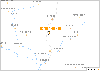
Liangchakou (Shaanxi, China)Liangchakou is a town in the Shaanxi region of China. An overview map of the region around Liangchakou is displayed below.
regional and 3d topo map of Liangchakou, China ::
Liangchakou airports ::
The nearest airport is XIY - Xi'an Xianyang, located 174.5 km north west of Liangchakou.
Nearby towns ::
Faguan (5.9km south) //
Shiyaozi (6.4km north) //
Yaojiawan (6.5km south east) //
Yaozhuangzi (6.4km east) //
Majiadian (6.8km north east) //
Chenjiayuan (7.3km west) //
Shangboling (8.6km south) //
[all distances 'as the bird flies' and approximate]  Places with similar names to Liangchakou, China ::
// Lengchok (SD)
// Leng-shui-k'u (TW)
// Làng Chúc (VN)
// Liangshuikou (CN)
// Liangshuikou (CN)
// Longshiqiao (CN)
// Llanquichaqui (BO)
// Linkishki (BY)
// Langshu Ga (MM)
Disclaimer :: Information on this page comes without warranty of any kind |
||
|
Where is Liangchakou? Elevation and coordinates ::
Latitude (lat): 33°19'11"N Longitude (lon): 110°4'2"E
Elevation (approx.): 591m (map arrows pan, magnifying glasses zoom) |
||
|
Visiting Liangchakou? Hotel/Accommodation ::
Book a hotel in Liangchakou Travel Guide ::
Buy a travel guide for China rental cars ::
car rental offers GPS waypoint ::
download a GPX waypoint (PoI) of Liangchakou for your GPS receiver
|
||