|
search place name
|
||
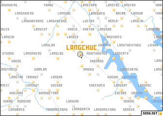
Làng Chúc (Vietnam)Làng Chúc is a town in Vietnam. An overview map of the region around Làng Chúc is displayed below.
regional and 3d topo map of Làng Chúc, Vietnam ::
Làng Chúc airports ::
The nearest airport is HAN - Hanoi Noibai Intl, located 147.0 km south east of Làng Chúc.
Nearby towns ::
Long Lâu (1.9km south) //
Khuông Chung (2.5km north west) //
Làng Chầy (3.7km north) //
Câm Kìa (3.7km north) //
Làng Thường (1) (3.4km east) //
Ngòi Thuồng (1) (3.4km east) //
Nà Hiếu (4.1km south east) //
Khê Nang (3.9km south east) //
Khê Cáng (3.9km south east) //
Làng Cô (4.1km north west) //
Khê Già (3.9km north east) //
Khê Kiêng (5.1km south east) //
Làng Lâu (5.2km west) //
Khê Cồ (5.8km north) //
Khâm Kìa (5.5km east) //
Khe Tha (5.8km north) //
Ðộng Quan (6.5km north west) //
Làng Ha (6.3km north east) //
Khê Kữm (6.3km north east) //
Làng Nờng (6.3km north east) //
Khê Cha (6.9km east) //
Làng Lạn (7.1km west) //
Khôn Chung (7.6km north) //
Lục Yên (7.6km north) //
Làng Mo (7.6km south west) //
Làng Chang (7.6km north west) //
Làng São (7.6km north east) //
Khê Chung (8.2km south east) //
Làng Xiêng (7.8km north east) //
[all distances 'as the bird flies' and approximate] 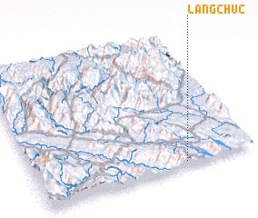 Places with similar names to Làng Chúc, Vietnam ::
// Lengchok (SD)
// Leng-shui-k'u (TW)
// Liangchakou (CN)
// Liangshuikou (CN)
// Liangshuikou (CN)
// Longshiqiao (CN)
// Llanquichaqui (BO)
// Linkishki (BY)
// Langshu Ga (MM)
Disclaimer :: Information on this page comes without warranty of any kind |
||
|
Where is Làng Chúc? Elevation and coordinates ::
Latitude (lat): 22°2'0"N Longitude (lon): 104°41'0"E
Elevation (approx.): 233m (map arrows pan, magnifying glasses zoom) |
||
|
Visiting Làng Chúc? Hotel/Accommodation ::
Book a hotel in Làng Chúc Travel Guide ::
Buy a travel guide for Vietnam rental cars ::
car rental offers GPS waypoint ::
download a GPX waypoint (PoI) of Làng Chúc for your GPS receiver
|
||