|
search place name
|
||
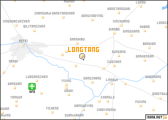
Longtang (Anhui, China)Longtang is a town in the Anhui region of China. An overview map of the region around Longtang is displayed below.
regional and 3d topo map of Longtang, China ::
Longtang airports ::
The nearest airport is HFE - Hefei Luogang, located 11.5 km south west of Longtang.
Other airports nearby include NKG - Nanjing Lukou (138.6 km east), Nearby towns ::
Dalucun (2.0km south west) //
Sanshibu (3.9km north) //
Ershipu (3.9km north west) //
Changxuecun (4.1km south east) //
Daxingji (4.3km west) //
Gangzhang (5.2km south) //
Cuozhen (5.8km east) //
Yixing (6.5km south west) //
Xiaoxingji (7.1km south west) //
Sungang (6.6km east) //
Linheji (7.4km south east) //
Dawei (8.2km south) //
Dianbu (8.2km north east) //
Xinzhuang (10.5km north east) //
[all distances 'as the bird flies' and approximate] 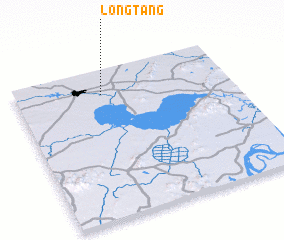 Places with similar names to Longtang, China ::
// Lingatong (PH)
// Liung Tangah (PH)
// Long Tengoa (MY)
// Langting (IN)
// Lengteng (IN)
// Lungding (IN)
// Lingadang (ID)
// Langtang (NG)
// Long Tong (LA)
// Longtawng (MM)
Disclaimer :: Information on this page comes without warranty of any kind |
||
|
Where is Longtang? Elevation and coordinates ::
Latitude (lat): 31°50'0"N Longitude (lon): 117°24'10"E
Elevation (approx.): 6m (map arrows pan, magnifying glasses zoom) |
||
|
Visiting Longtang? Hotel/Accommodation ::
Book a hotel in Longtang Travel Guide ::
Buy a travel guide for China rental cars ::
car rental offers GPS waypoint ::
download a GPX waypoint (PoI) of Longtang for your GPS receiver
|
||