|
search place name
|
||
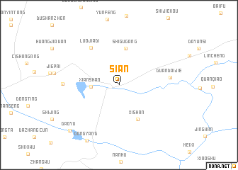
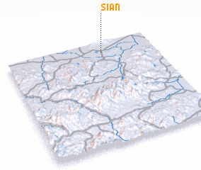
Si'an (Zhejiang, China)Si'an is a town in the Zhejiang region of China. An overview map of the region around Si'an is displayed below.
regional and 3d topo map of Si'an, China ::
Si'an airports ::
The nearest airport is HGH - Hangzhou Xiaoshan, located 105.4 km south east of Si'an.
Other airports nearby include NKG - Nanjing Lukou (120.1 km north west), SHA - Shanghai Hongqiao Intl (164.0 km east), NGB - Ninbo Lishe (210.5 km south east), Nearby towns ::
 Places with similar names to Si'an, China ::
Disclaimer :: Information on this page comes without warranty of any kind |
||
|
Where is Si'an? Elevation and coordinates ::
Latitude (lat): 30°53'54"N Longitude (lon): 119°39'13"E
Elevation (approx.): 14m (map arrows pan, magnifying glasses zoom) |
||
|
Visiting Si'an? Hotel/Accommodation ::
Book a hotel in Si'an Travel Guide ::
Buy a travel guide for China rental cars ::
car rental offers GPS waypoint ::
download a GPX waypoint (PoI) of Si'an for your GPS receiver
|
||